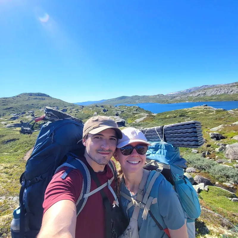
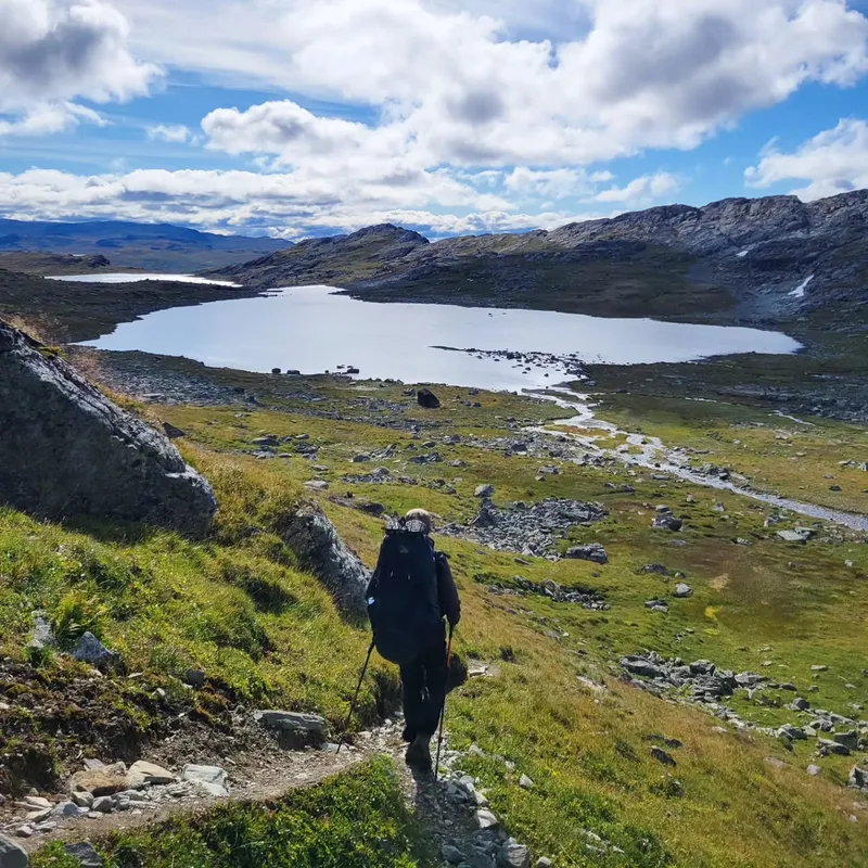
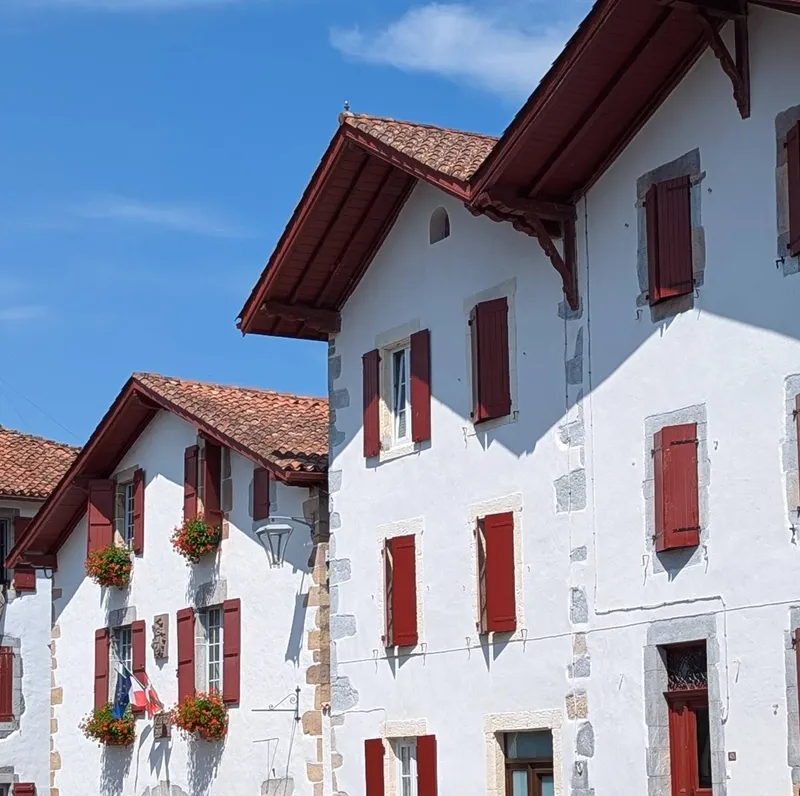
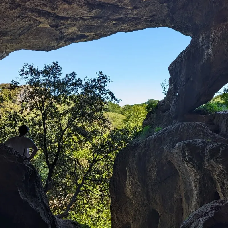
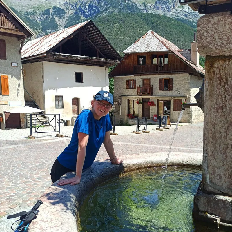
Norway — MASSIV
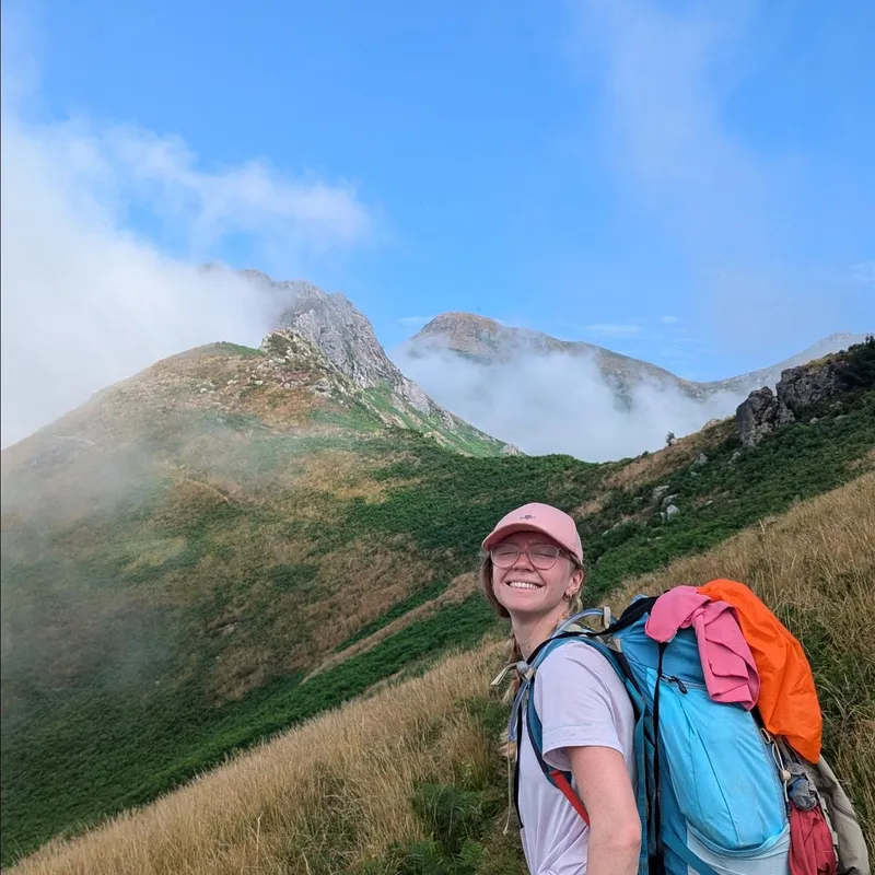
11 days across Jotunheim & Skarvheimen. 216 km, ~6500m D+.
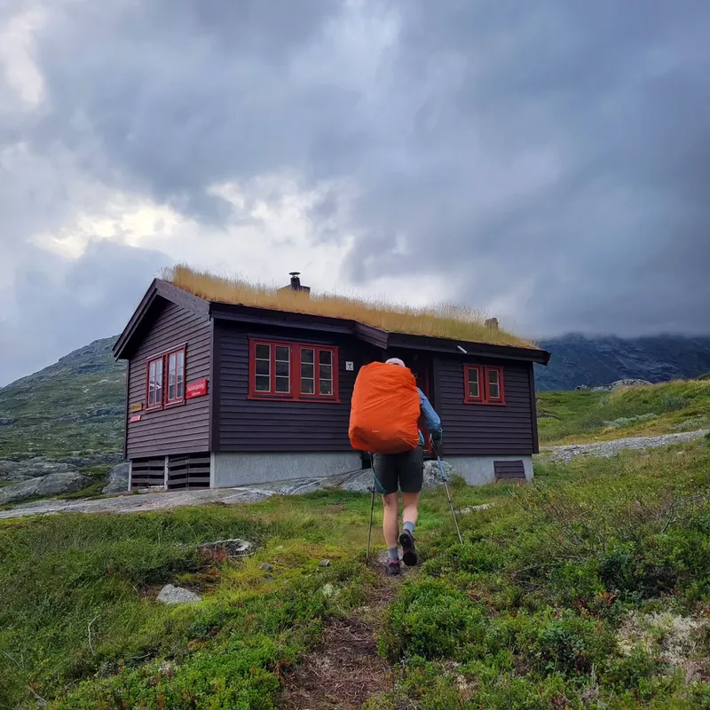
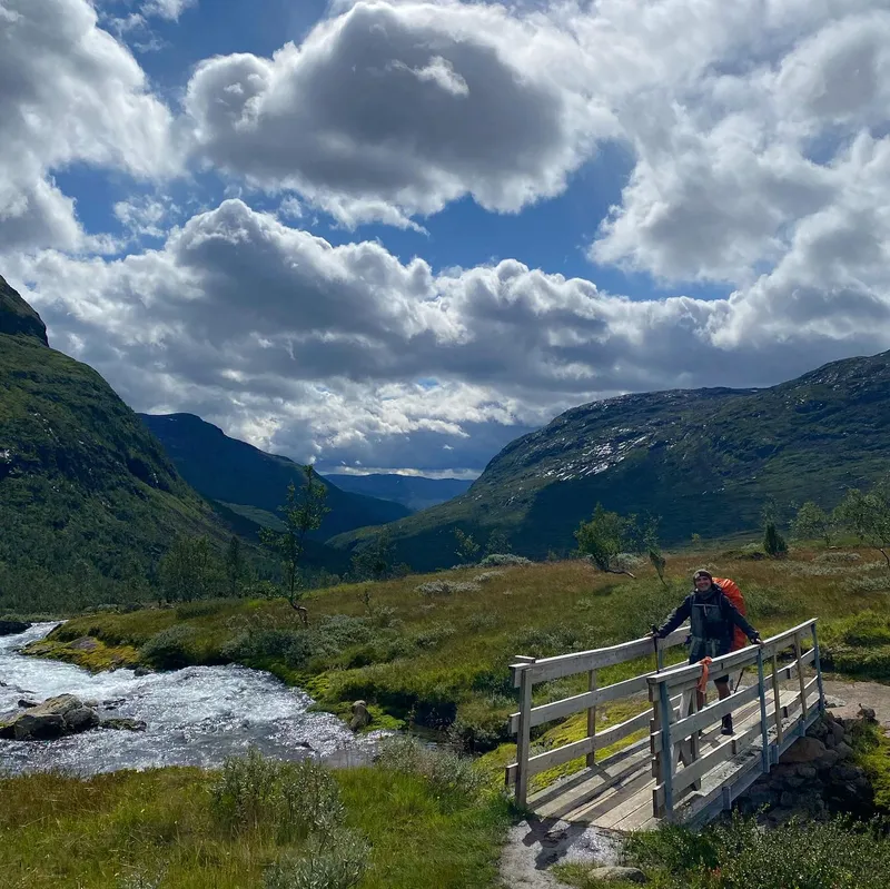
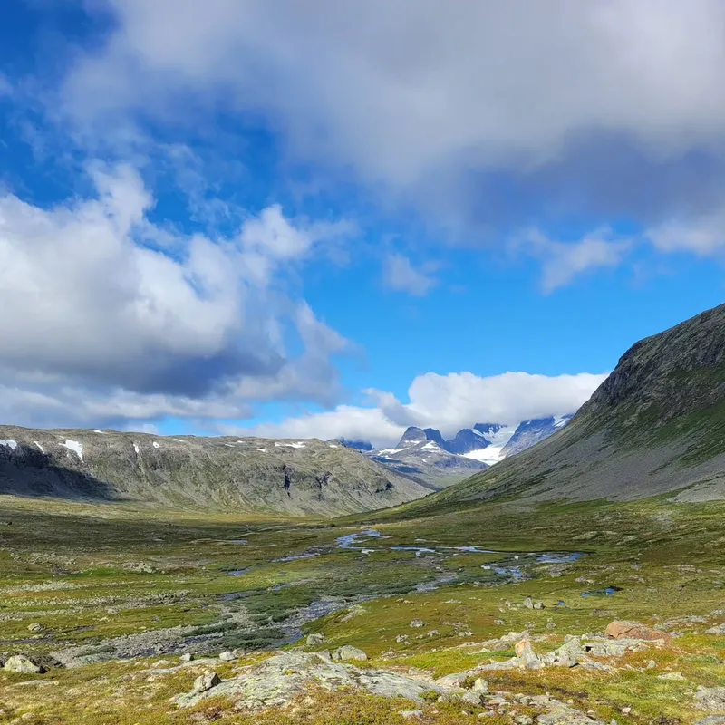
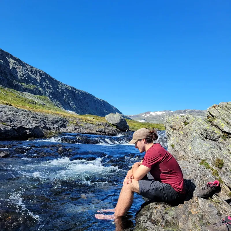
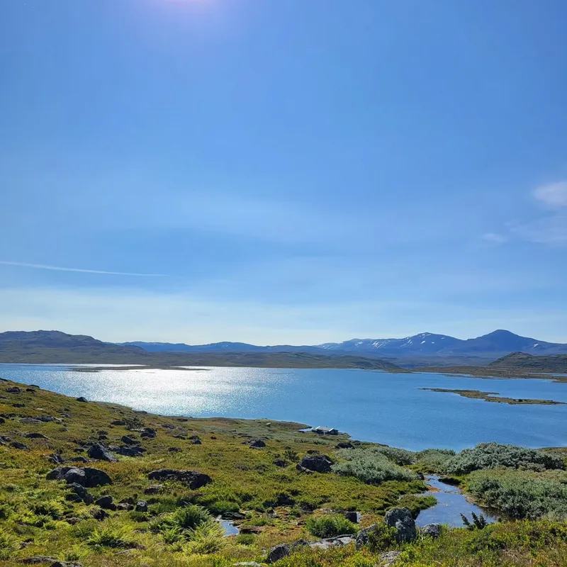
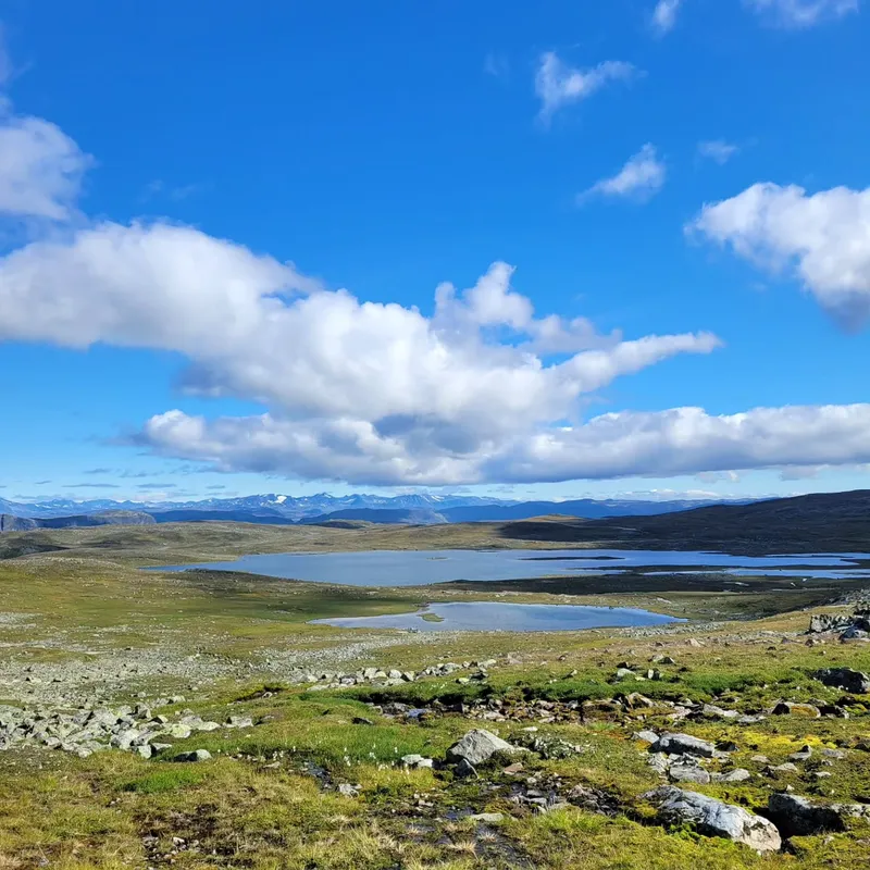
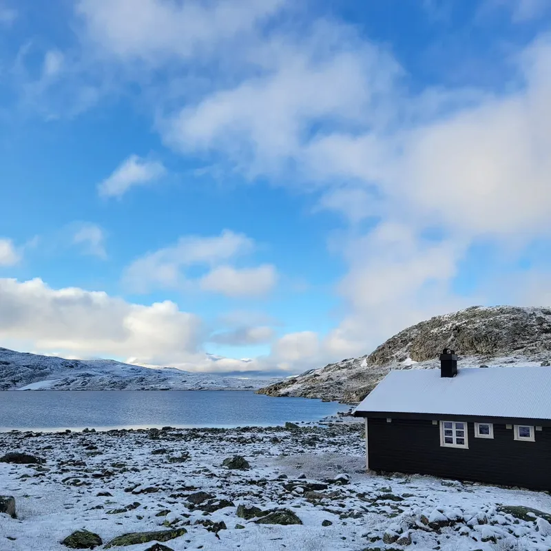
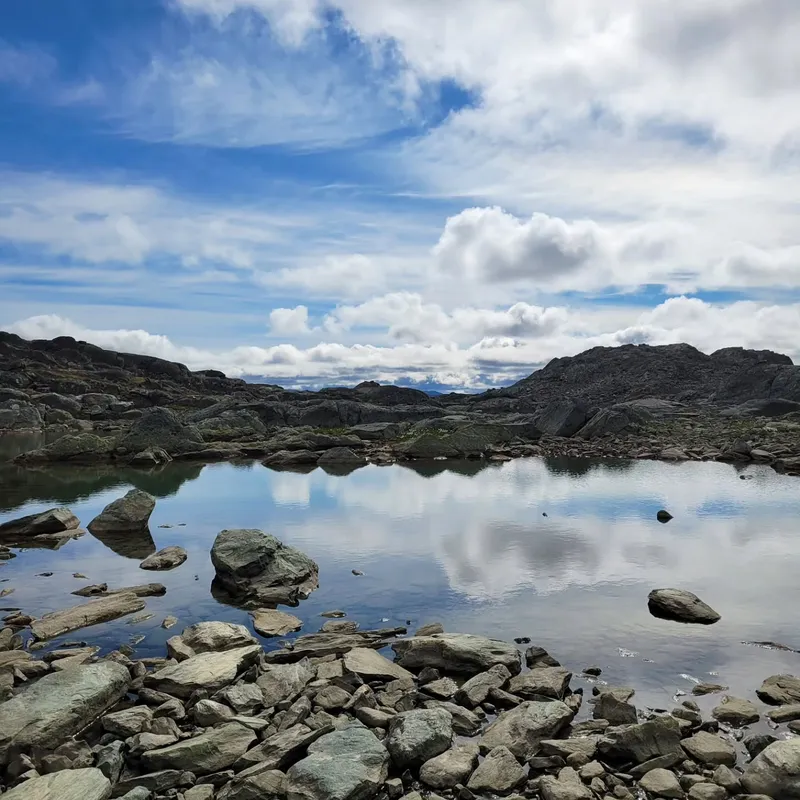
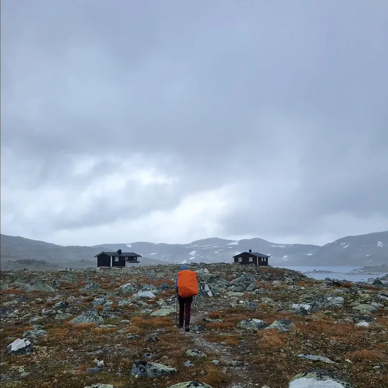
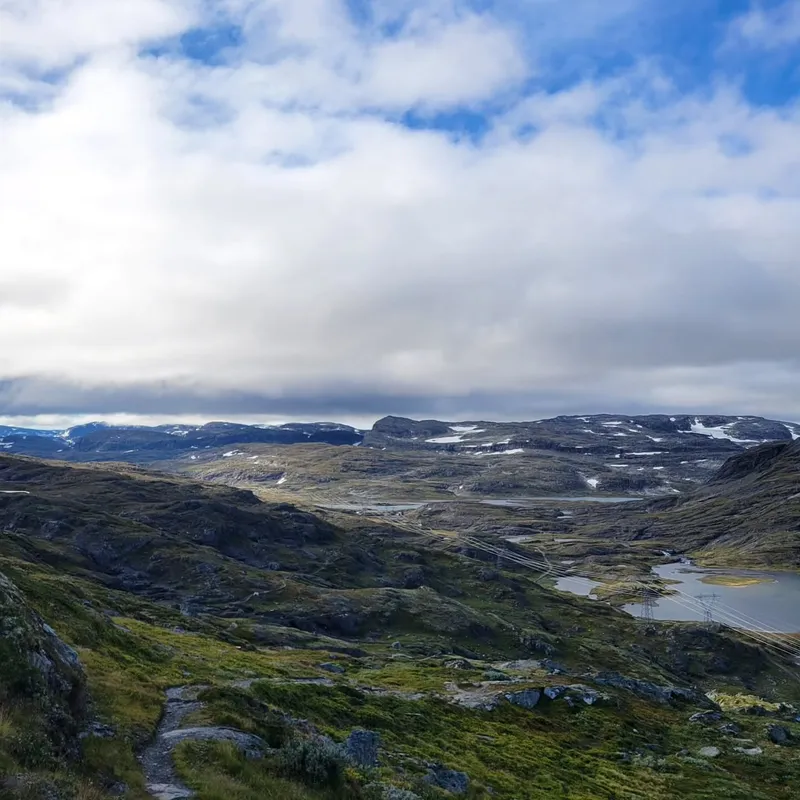
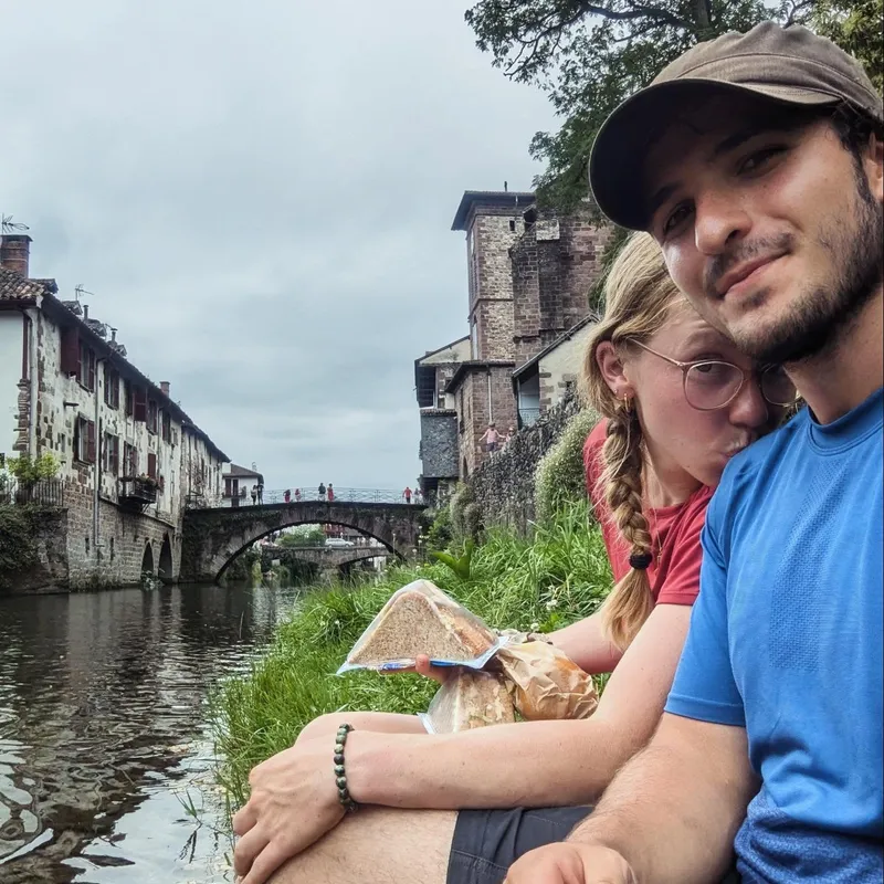
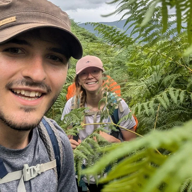
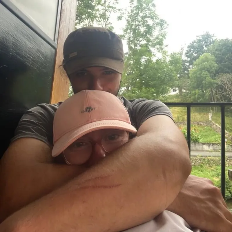
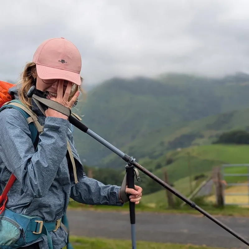
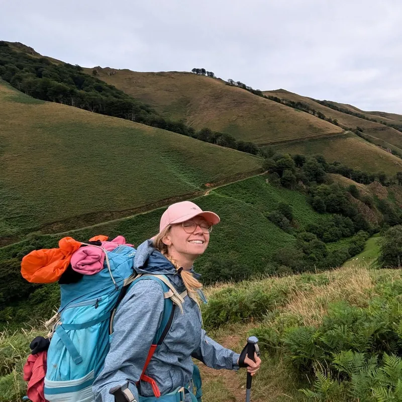
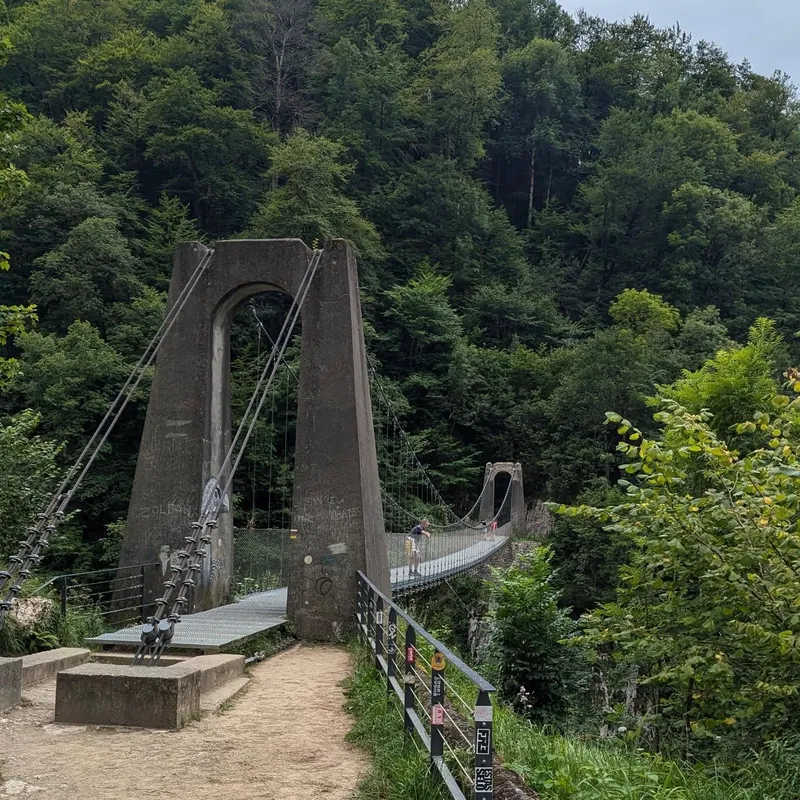
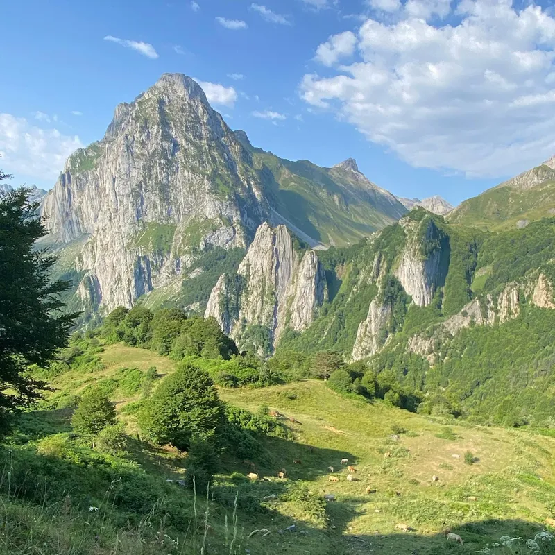
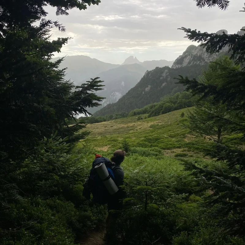
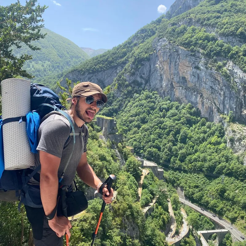
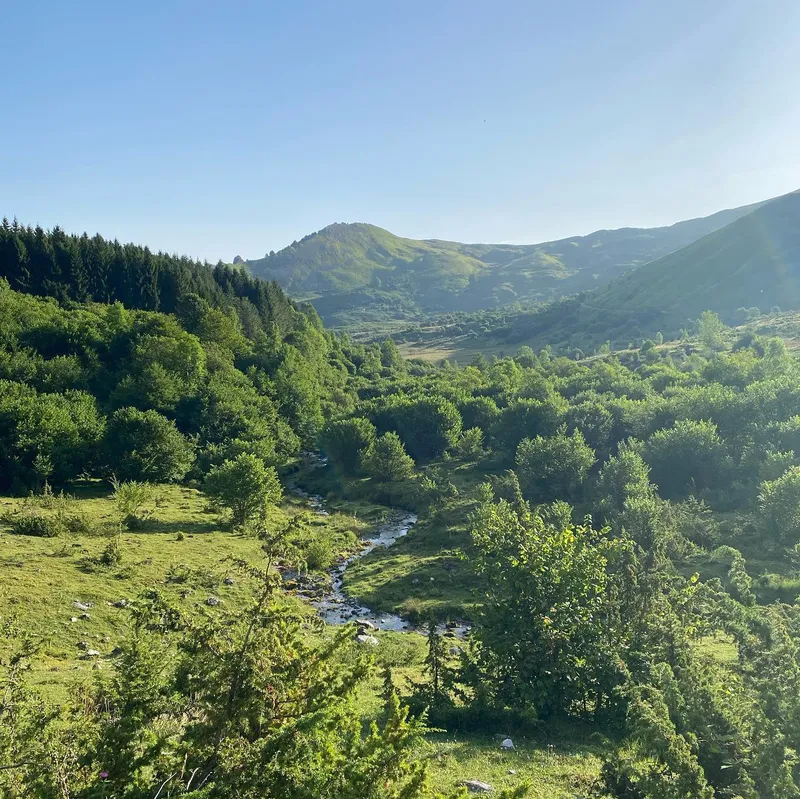
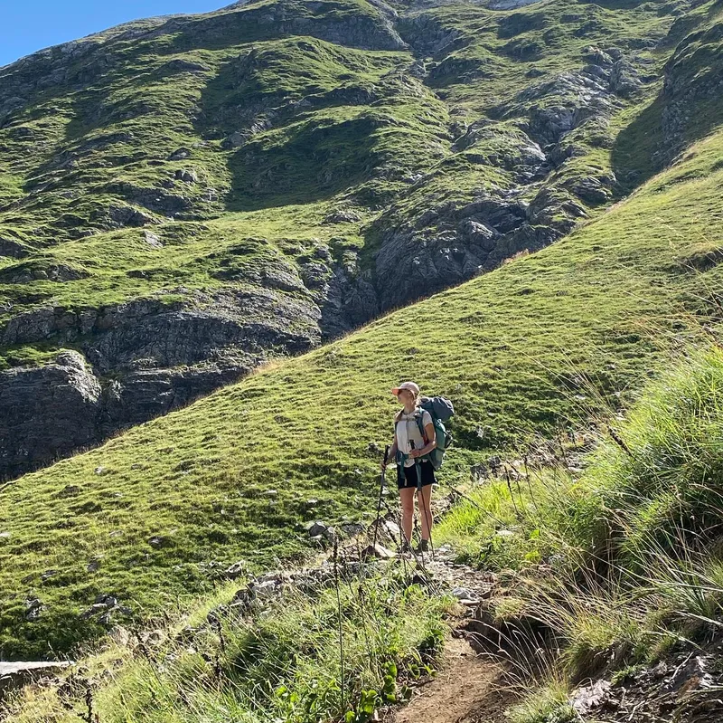
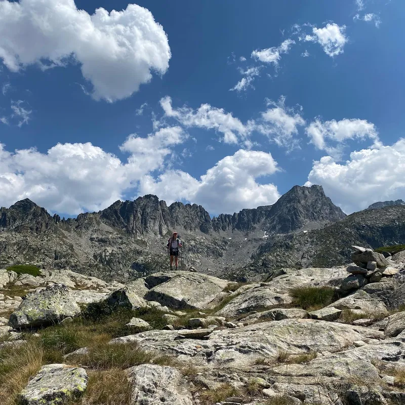
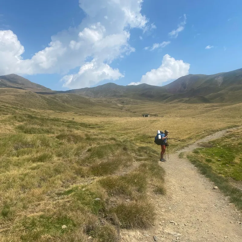
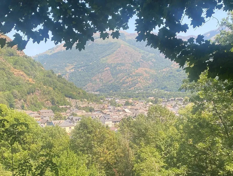
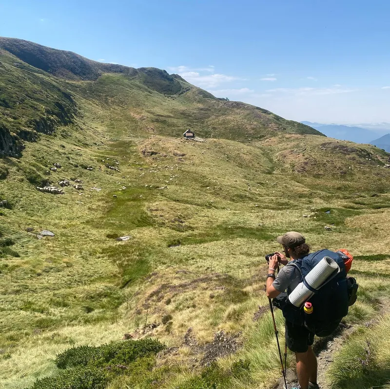
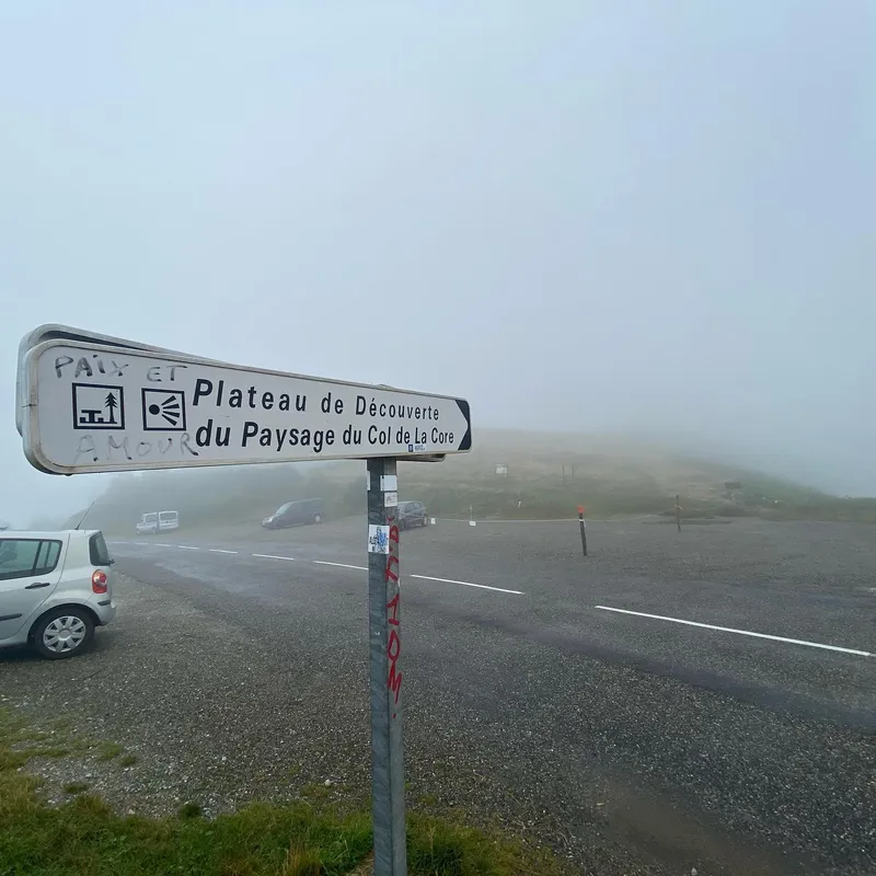
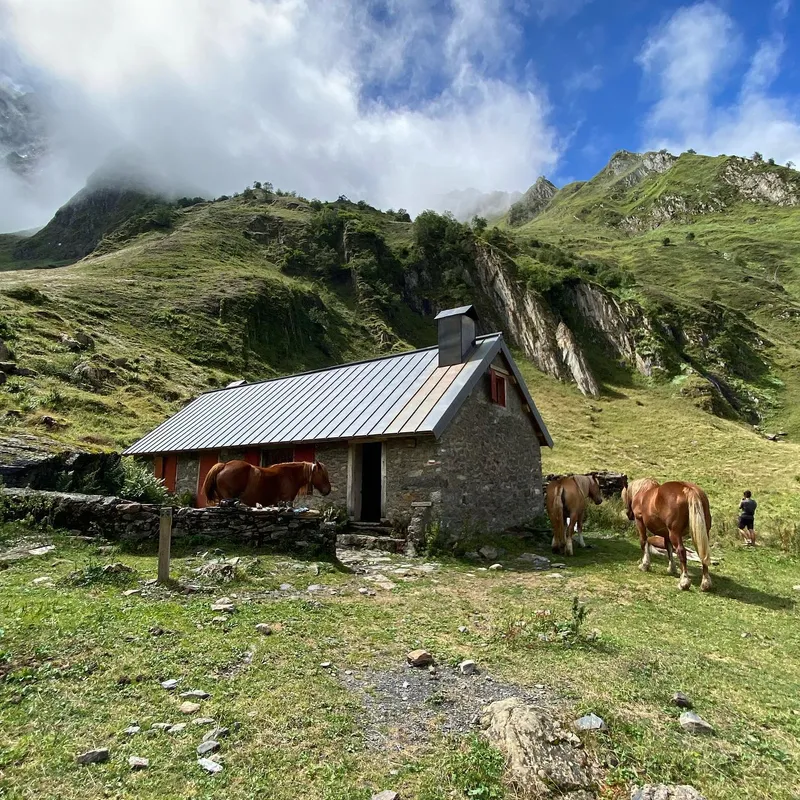
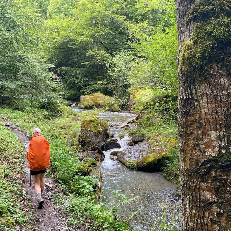
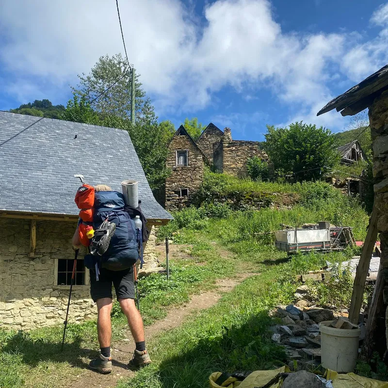
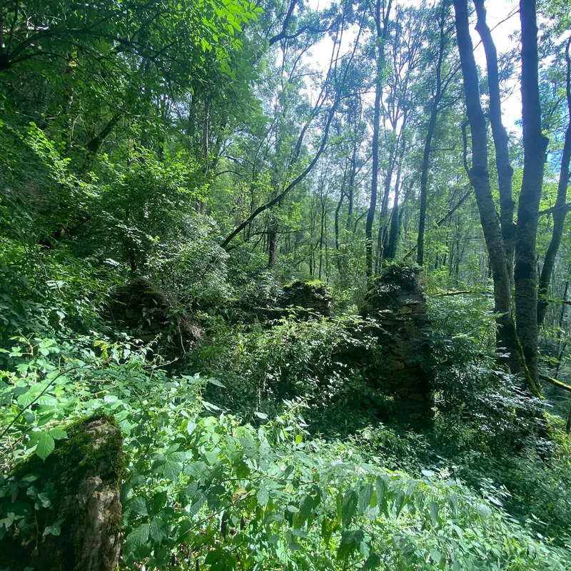
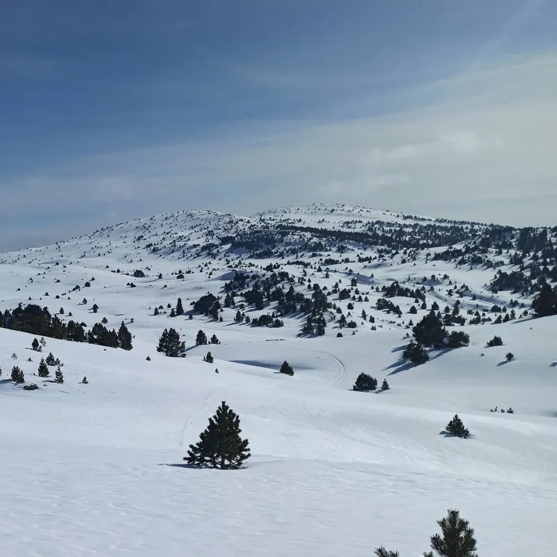
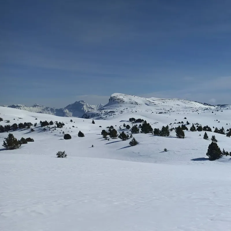
Sota Saeter → Norstedalseter
 9 photos
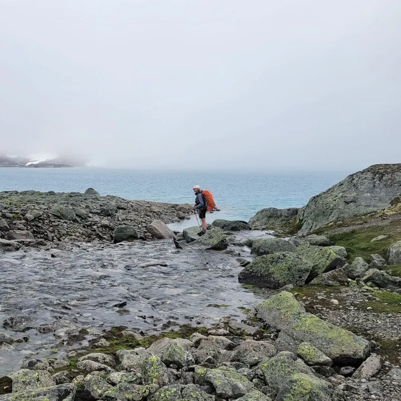
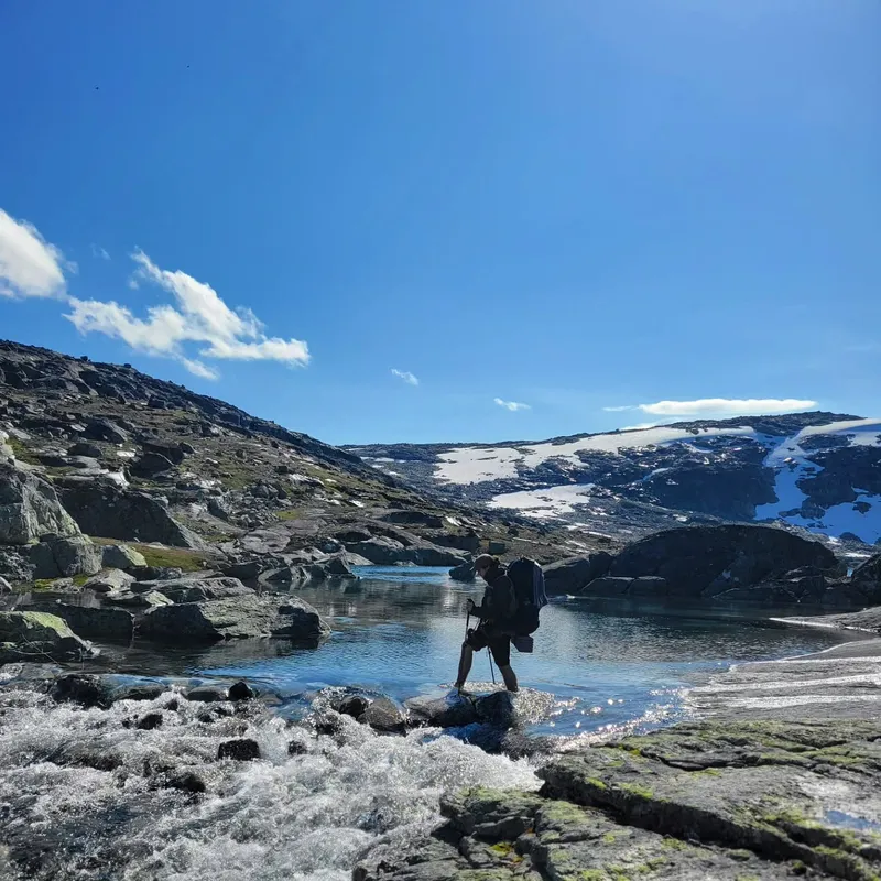
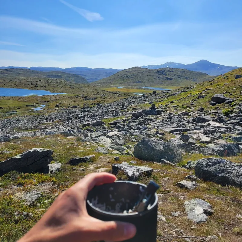
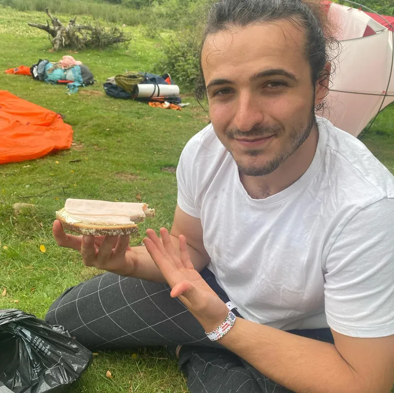
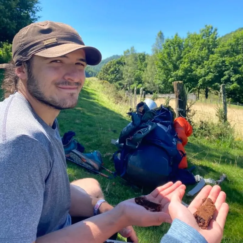
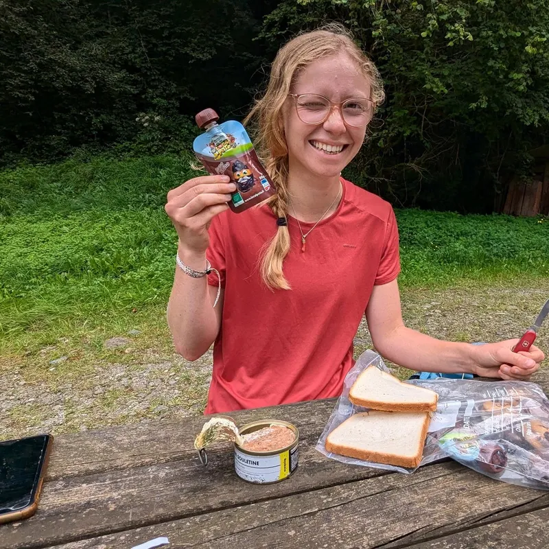
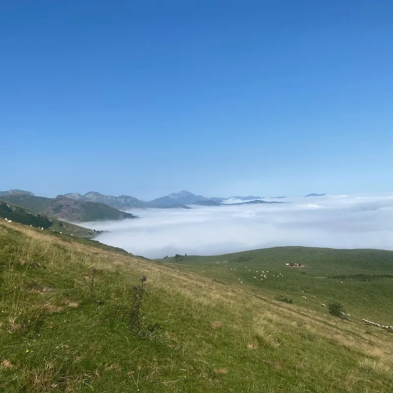
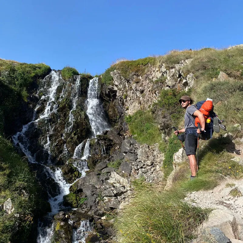
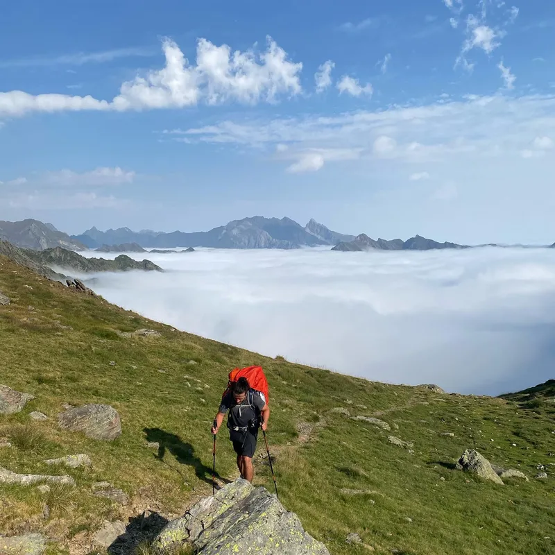
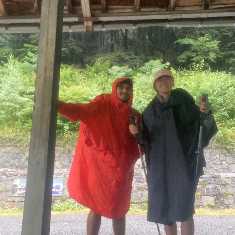
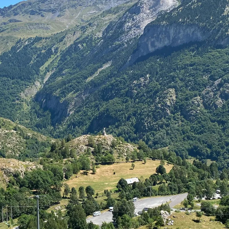
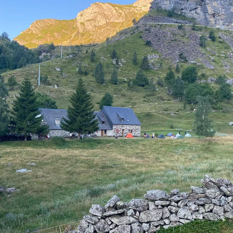
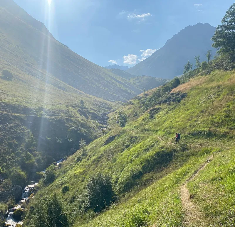
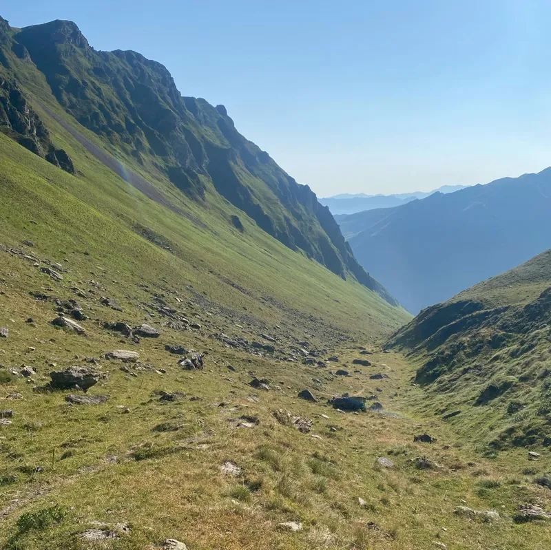
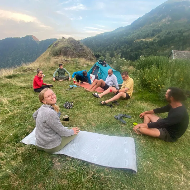
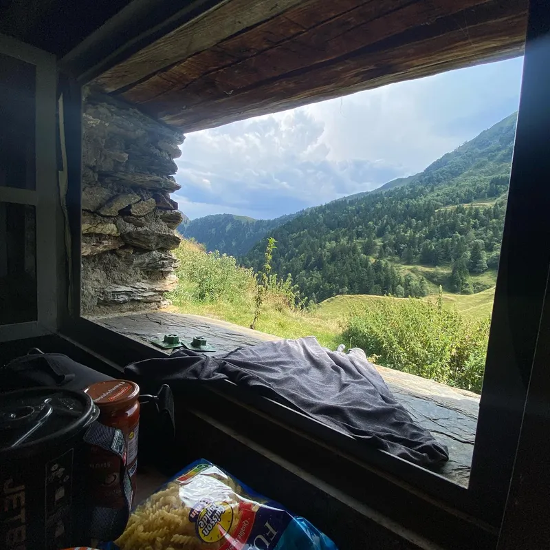
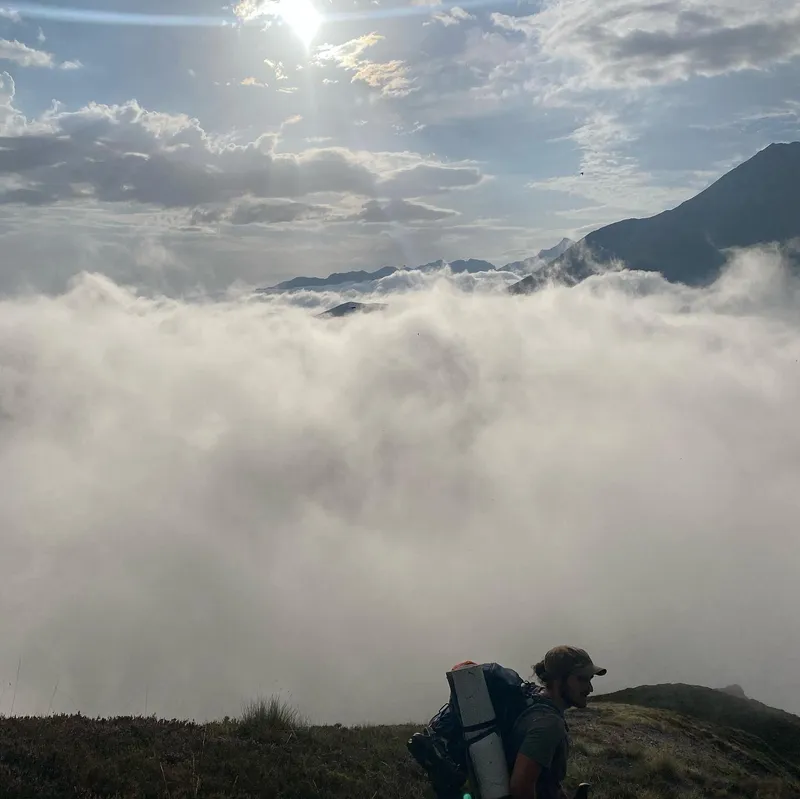
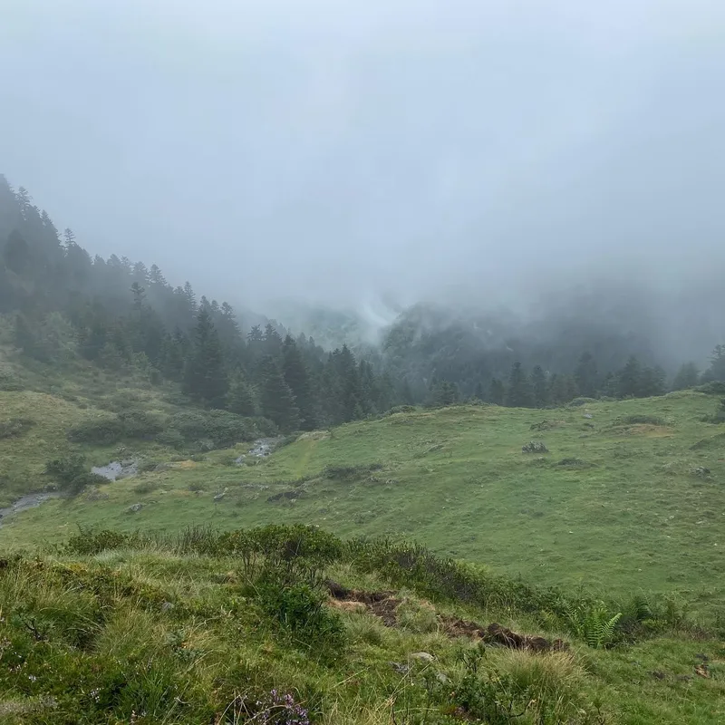
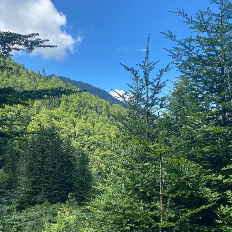
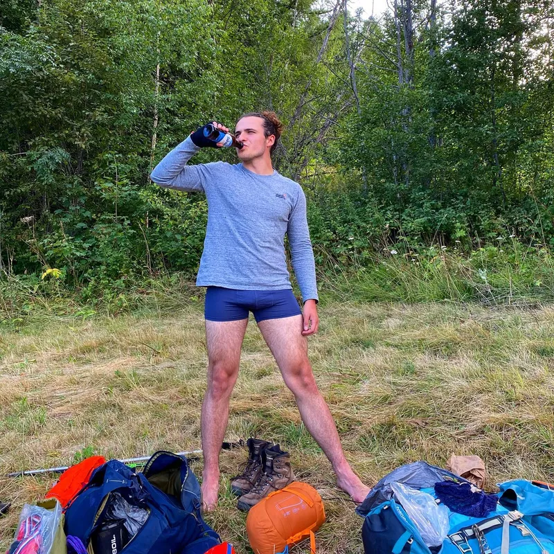
 We were specifically warned about today (and tomorrow.) The reason was obvious. These are the two longest, and steepest days of the trip. However the "10h" hiked still felt excessive...
We were specifically warned about today (and tomorrow.) The reason was obvious. These are the two longest, and steepest days of the trip. However the "10h" hiked still felt excessive and did not map to any of our Pyrenees data.
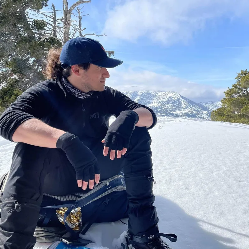
Cocky but cautious we left at 8am, happy with an especially cosy night. We climbed up under clouds, and rushed through the steep section proud with our performance, mocking the overly frequent markings (we could at one point see 7 marks at once) but it's only once we reached the top that the true challenge began...
It didn't take 10h, we hiked 11. Not including stops which, honestly wouldn't change a thing because all 4 of our brakes were cut short with rain. Up there the frequent markings made sense, we couldn't see 20m ahead of us at times with the constant fog.
I could go on and on, one positive is we never felt bored, the 11h actually went by fast. But the water... the water everywhere. In the fog, in the lakes, in the constant rivers we had to cross, which led to water in our shoes. Water in the path we're meant to take, water on Mathilde's glasses, water on every rock causing us to slip, and we weren't even thirsty.
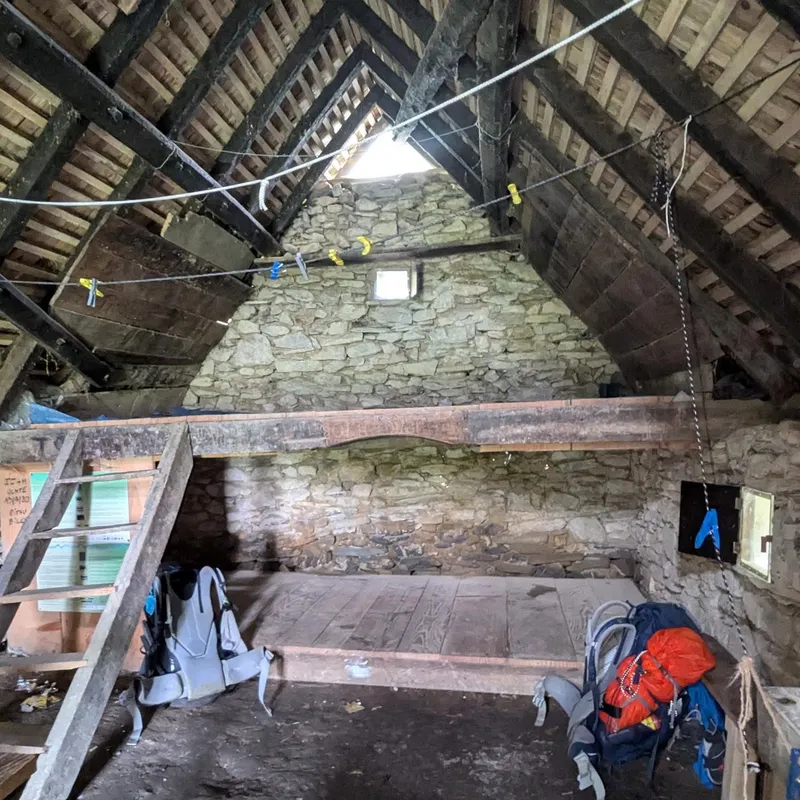
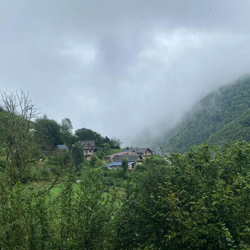
And yet the day ends on a great note as we reached the cabin, worried about the price. 16 bucks. 16 bucks for a nice bed, a kitchen, and the ability to dry and refuel. We might sleep in a lot more cabins than we'd planned...
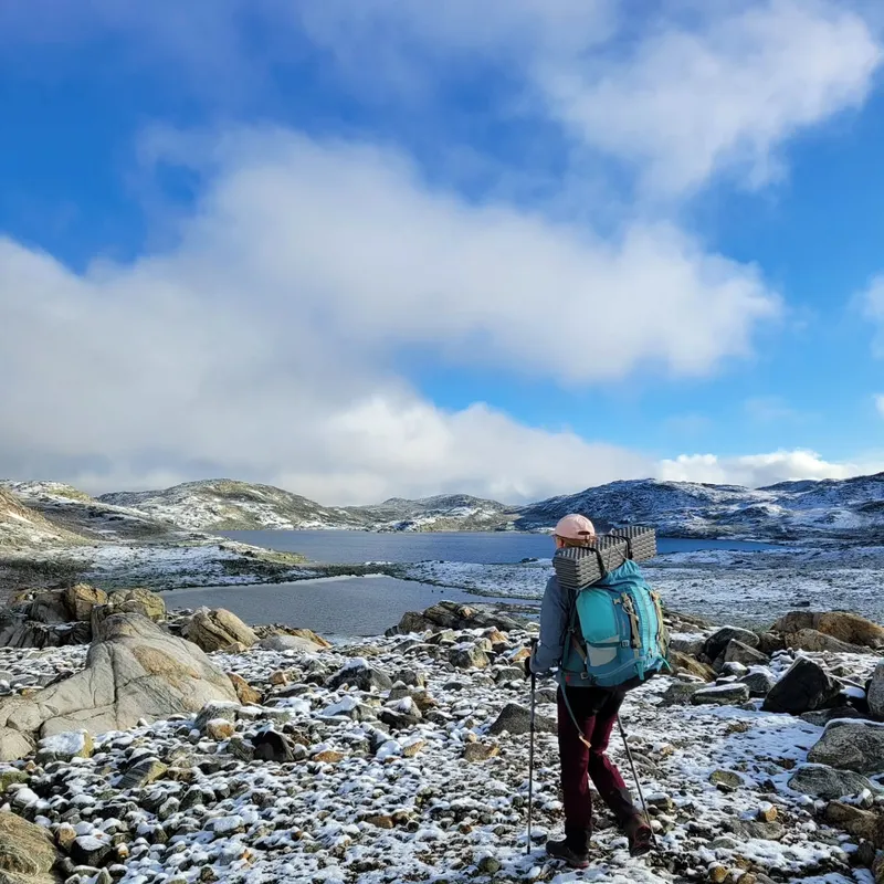
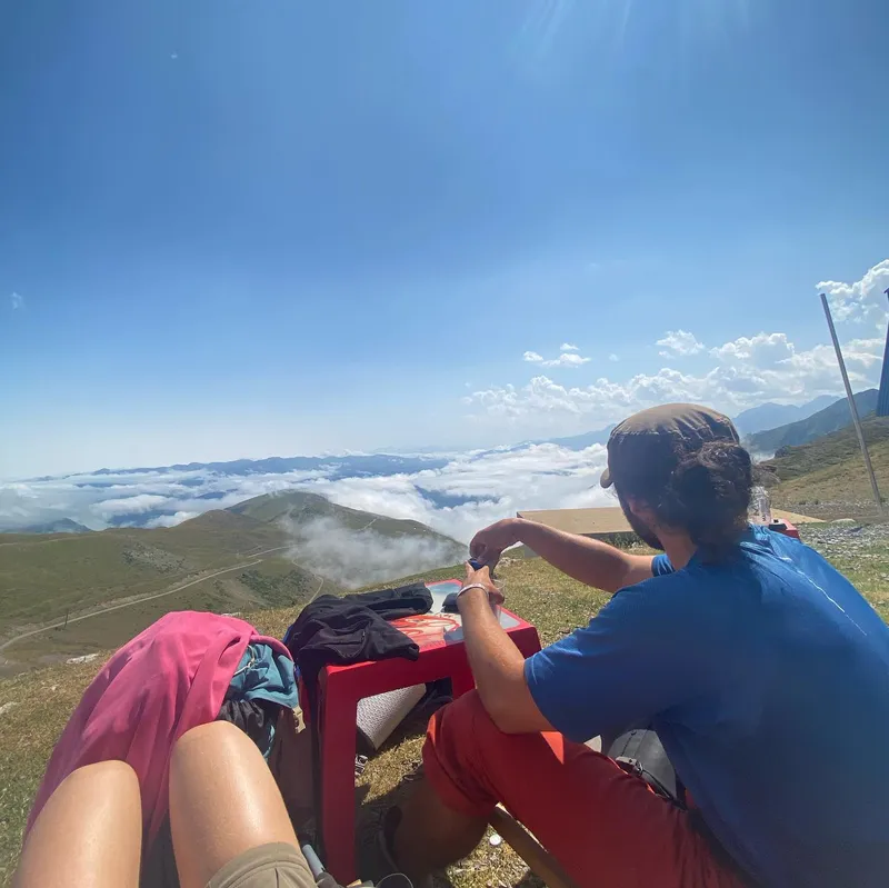
show lessNorstedalseter → Sognefjellshytta
 11 photos
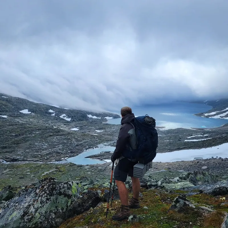
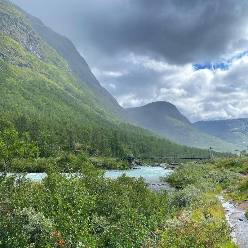
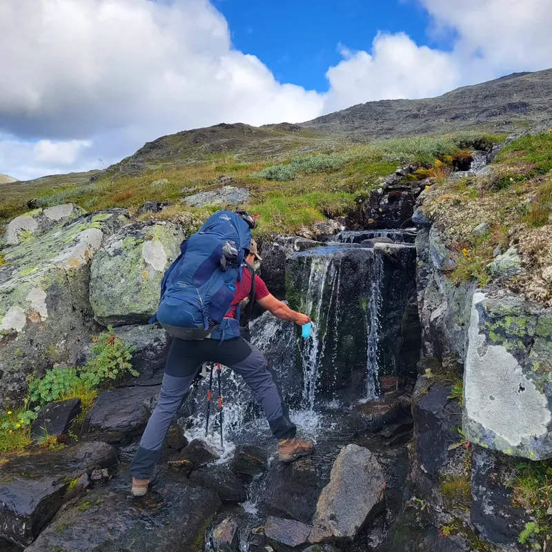
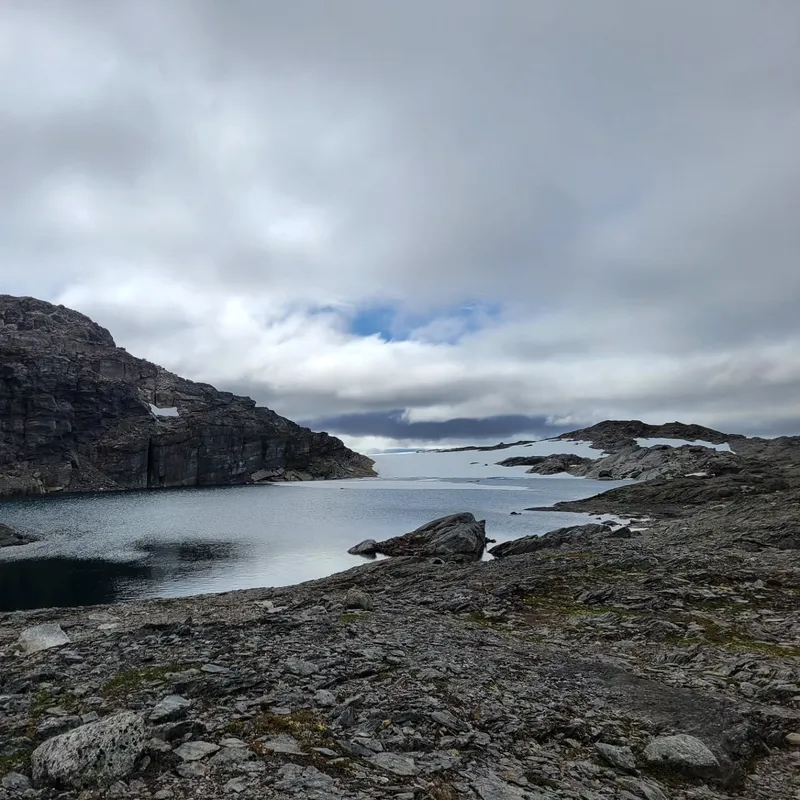
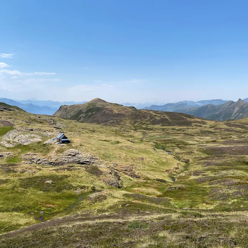
 The weather forecast for today was always optimistic, promising a sunny morning, but as we woke up from our beds we noticed a familiar fog and even some raindrops on...
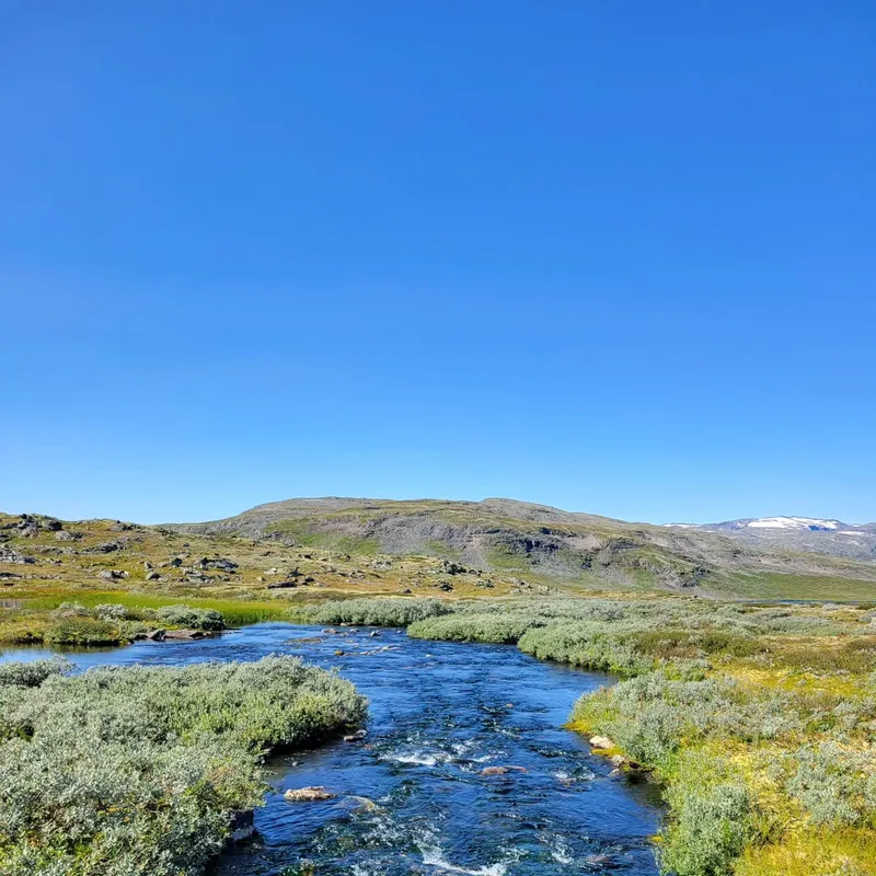
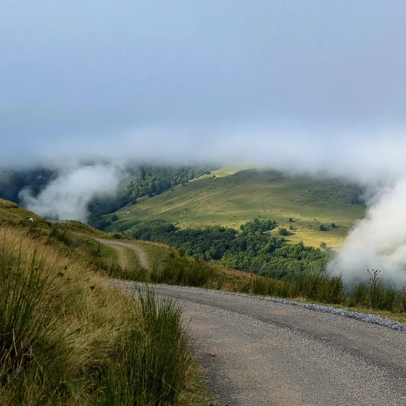
The weather forecast for today was always optimistic, promising a sunny morning, but as we woke up from our beds we noticed a familiar fog and even some raindrops on our windowsills. Still we used the kitchen to make breakfast while learning more about our roommates. One of them was actually not here to enjoy himself, but rather on a field trip to map vegetation and animals near a dam soon-to-be renovated.
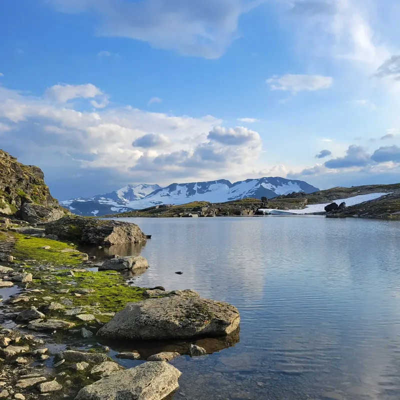
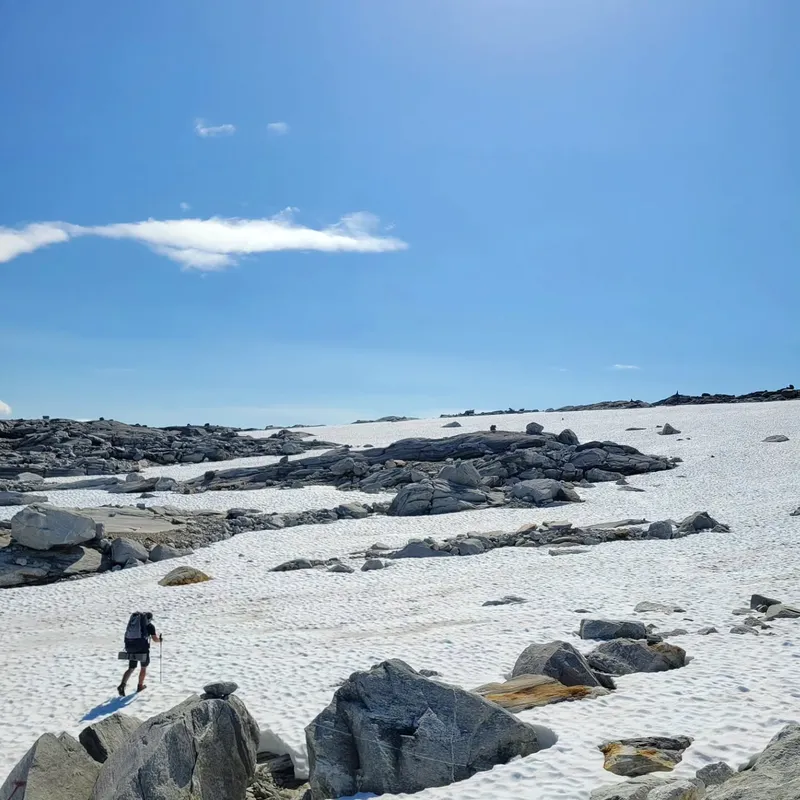
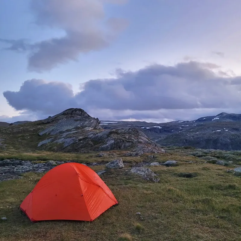
Anyways the morning really isn't the highlight of our day, since the further we walked the sunnier it became. We soon removed our rain jackets, rolled up our sleeves, only to change into t-shirts and put on sun screen.
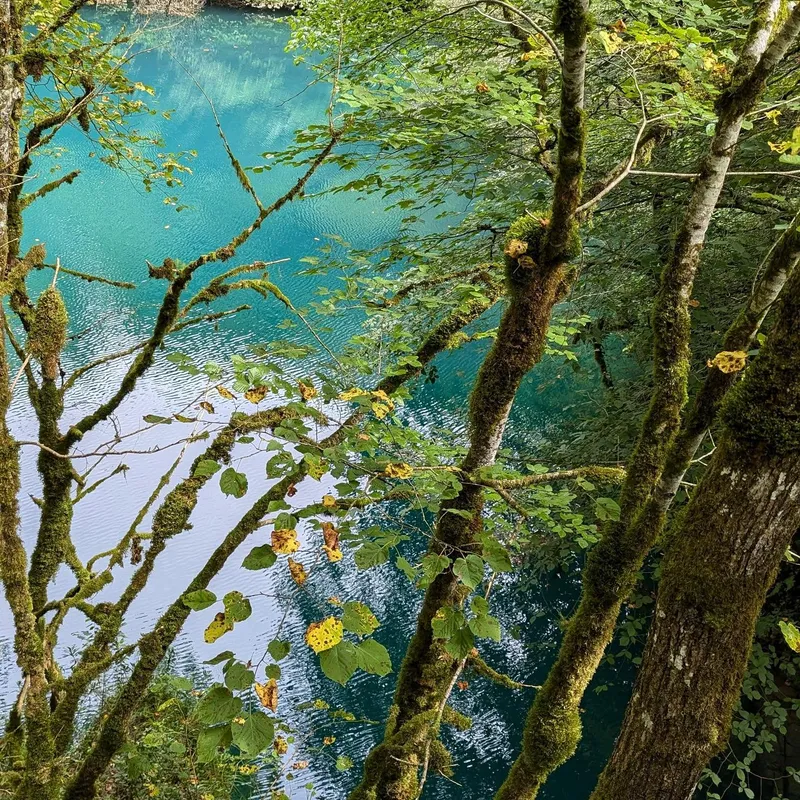
We hiked through rivers and lakes (obviously) but also glaciers and snow. We found a beautiful lunch spot where we dried our tent and tried a new recipe: rice cooked the day before mixed with an actual cube of chicken. Like, 500g of "chicken" hydrolic pressed into a cube or something. Probably some act of defiance to god, but it tasted great and fixed our apparent caloric deficit from the day before.
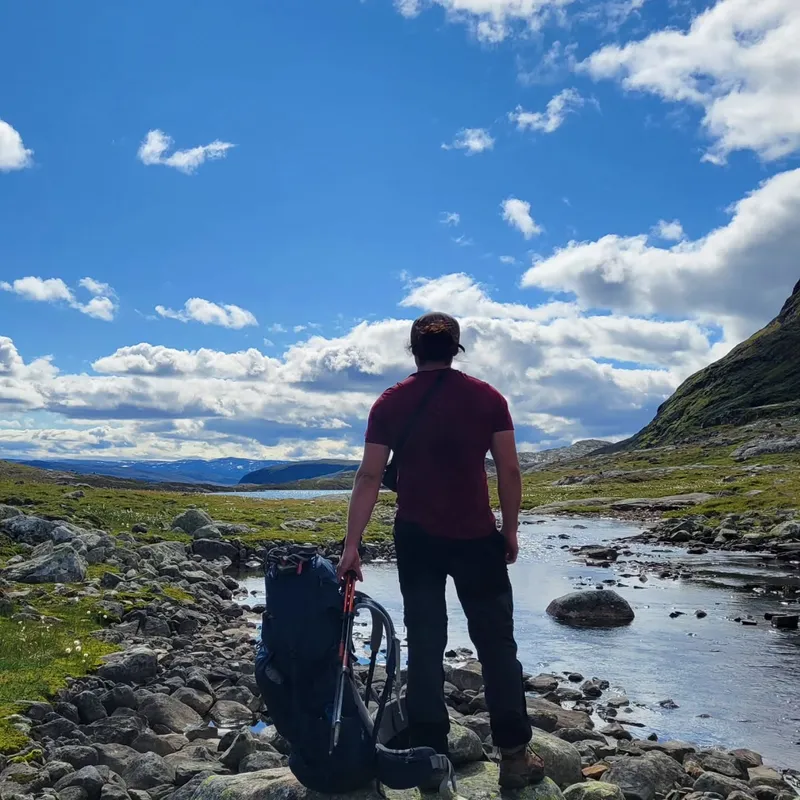
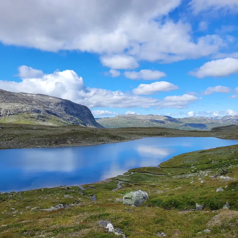
As we kept walking we slowly strolled back down the glacier only to see the most beautiful, grandiose sight I (Ixil) had ever seen. Obviously the picture doesn't do it justice but we paused again just to bask it in.
The rest of the day was still fun but also overstayed its welcome and we both were more than happy to stop 2km early by a cosy spot we'd found, with view on more glaciers, although potentially too exposed to winds.
show lessSognefjellshytta → Skogadalsboeen
 8 photos
 We picked the day off finishing yesterday's hike and going to Sognefjellshytta. This is where we found a small wooden cup-spoon which we instantly recognized. We haven't mentioned him yet,...
We picked the day off finishing yesterday's hike and going to Sognefjellshytta. This is where we found a small wooden cup-spoon which we instantly recognized. We haven't mentioned him yet, but so far we've had only one trekking neighbour. He's old, but way faster than us, speaks Norwegian, French and English and is quite shy. His footsteps have guided us through many confusing sections but for the first time, we caught up to him and handed it back. He took a picture of us, we think that means thx.
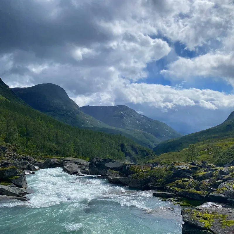
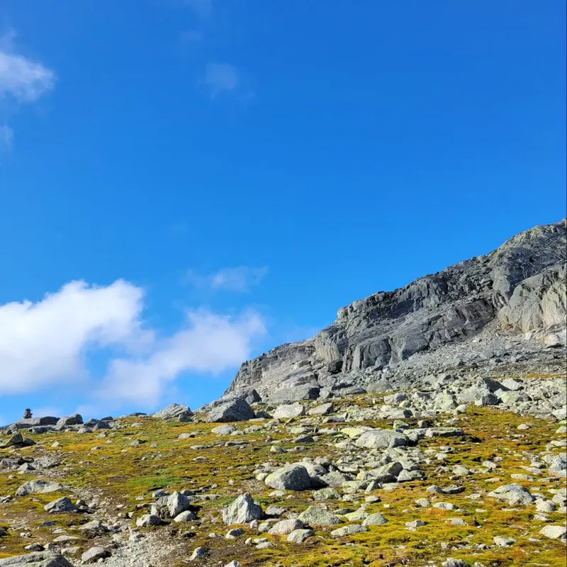
Obviously the question on everyone's mind: "isn't day 3 of Massiv the famous glacier walk up to Fannarakhytta?!" Yes. Yes it is. But even though the summer is winding down, and we were told not to worry, and we had seen only 4 hikers thus far, and yesterday and tomorrow have much better weather... Today of all days is the day 30 other people decided to book the mandatory guide up the glacier. So we skipped it.
Honestly we think those 30 people regretted their decision because we didn't. As we hiked down we had enough trouble handling the rain, we can't imagine what hiking the glacier was like when you're in the clouds themselves. The winds were so strong as well, but we pushed on, still relatively pleased knowing how this day compared with the first.
The landscapes progressively changed as we hiked down our first true valley and walked on its floor. Eventually we learned to ignore the weather and just pushed onwards knowing every rain was temporary and not worth changing clothes for.
Once we reached our cabin. We paid for facilities access and hitched our tent nearby at 4pm, a record thus far. Leaving us plenty of time to reset, read, and get bored and wait for our bedtime.
show lessSkogadalsboeen → Fondsbu
 7 photos
 Today was strange. We left early, waking up at 6am from yesterday's busy cabin, hiked all day seeing very few people (4 in our direction, 7 in the other) only...
Today was strange. We left early, waking up at 6am from yesterday's busy cabin, hiked all day seeing very few people (4 in our direction, 7 in the other) only to make it to Fondsbu's also-busy serviced cabin.
The path in-between was once again a challenge, with the typical issues of wet paths and uneven rocky sections (our ankles are on fire) but above all the wind: hitting us and pushing us all day, refreshing itself further on the many glacier lakes we hiked by. As such, we stopped very little today, barely drank, motivated above all by the fear of letting our bodies cool down in such conditions.
Reaching the cabin was a nice change of pace. The dormatory seems amazing and well sectioned. We got to shower and play Scrabble before heading for dinner. There, we were sat with two New Yorkers we had seen the day before. Despite what you would assume, if our math is correct, they're actually quite fast walkers. They left after us but arrived little after us while taking 10min breaks after every 50min walk (apparently it's a famous technique.)
But the REAL thing to be jealous about, is that they saw reindeers twice on the trail when we'd completely given up on it. We'll start looking out again, I guess...
Finally, the food was indeed up to the reputation. Quite delicious and filling. Including a carrot cake in the end and a lullaby song from the hostess prior to the main course.
show lessFondsbu → Slettningsbu
 8 photos
 We left behind many great new friends today: the New Yorkers (Bryan and Hannah) and the Germans (Sebastian and Sophia) after a great breakfast together. 30 min in, our first...
We left behind many great new friends today: the New Yorkers (Bryan and Hannah) and the Germans (Sebastian and Sophia) after a great breakfast together.
30 min in, our first fun little challenge, I (Ixil) realize I forgot my (my dad's) rain jacket! How jolly! Mathilde is very amused (she isn't), and so I make use of the great tarmac we were on to do a morning 5k there and back!
Otherwise we were genuinely glad for the road walking, after days of swamp the tarmac (and then dry dirt paths) were more than welcomed. Despite the distance being similar to previous days it meant much quicker hiking speeds and overall a shorter day (day 1 was 11h for that same distance). It also meant we finally allowed ourselves breaks: dipping our feet in the river, taking out the camera or skipping rocks on the lake. That is... until the "situation".
See despite the all day sun, eventually the dirt path does become a swamp, a swamp like never before, with no escape, rocks to jump on or anything. We had to take our non-waterproof shoes and just walk through mud for like an hour and I hated it (honestly we laughed it off pretty well.)
But the real star of the show was the cabin, where we met our new trekking neighbors for the foreseeable future. A hut by the lake, Norway-core personified with candles and a fireplace. I noticed a hole in my pants and sewed while Mathilde cooked reindeer meatballs with mash potatoes. Good vibes...
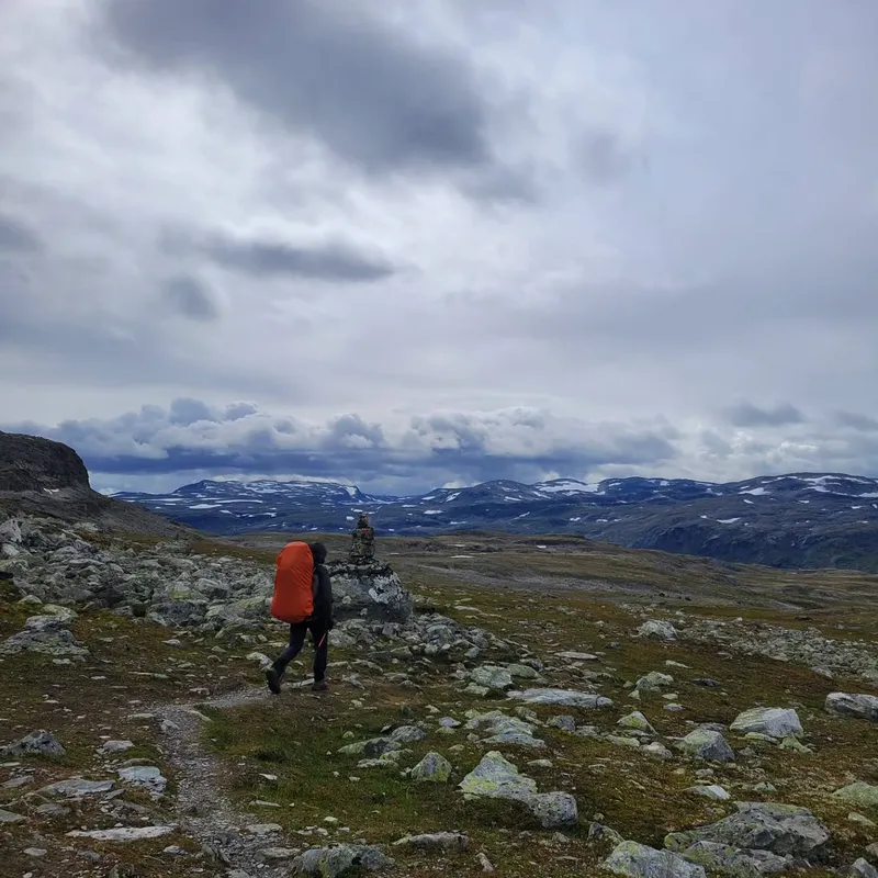
show lessSlettningsbu → Sulebu
 10 photos
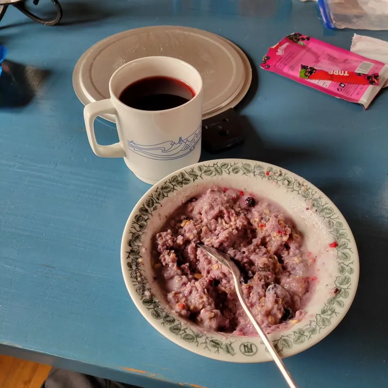
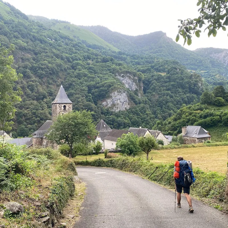
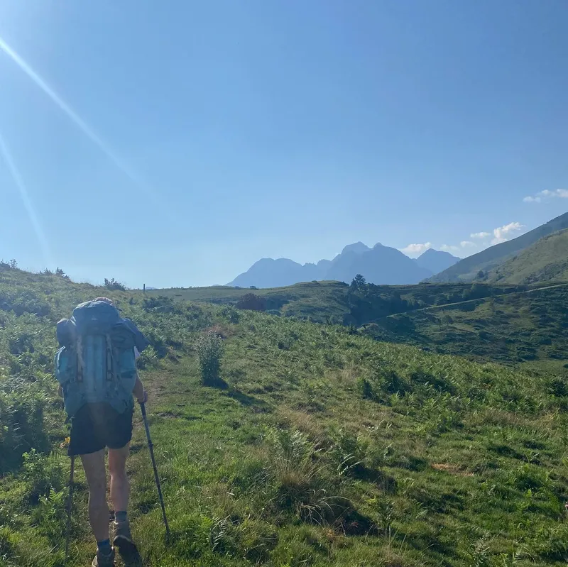
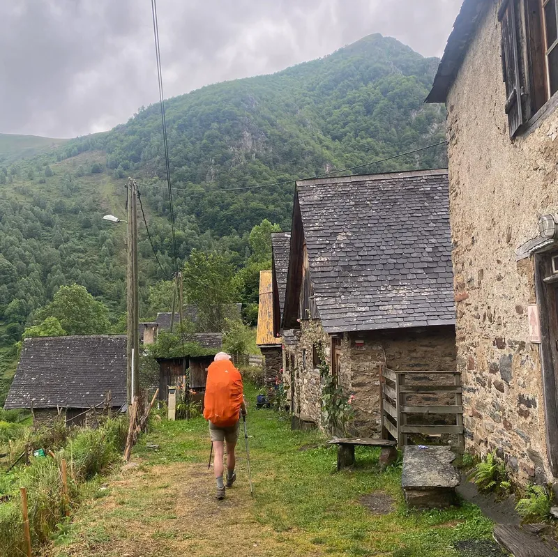
 Today we left Jotunheim park to enter Skarvheimen. We said goodbye to our beautiful cabin after a delicious oatmeal preparation (only 160 NOK!) We say goodbye to our trekking neighbors,...
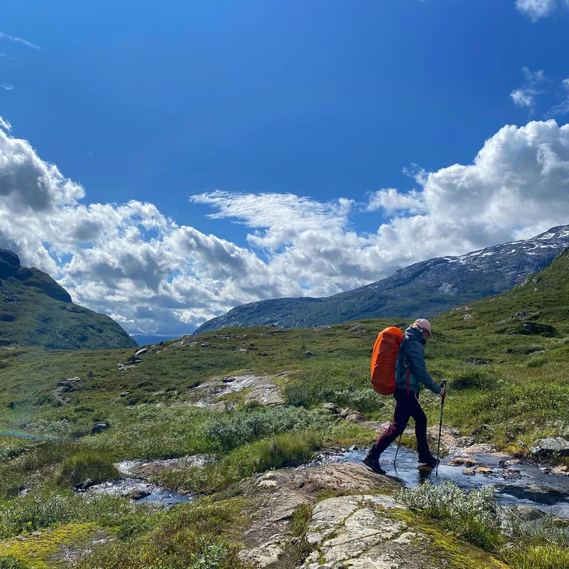
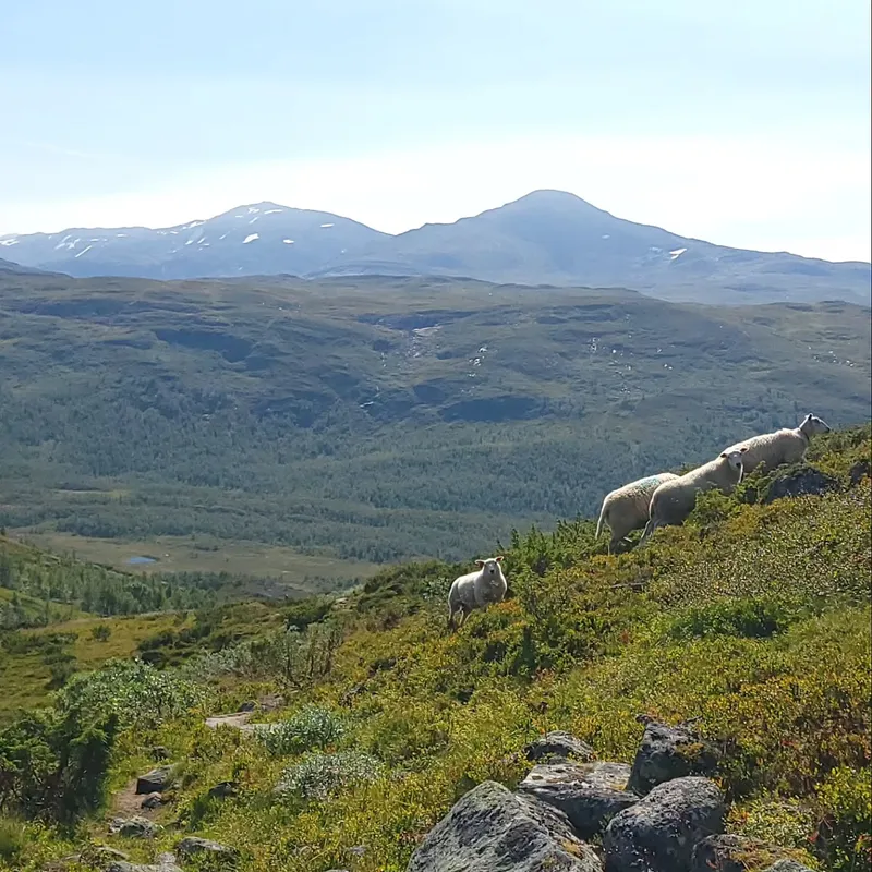
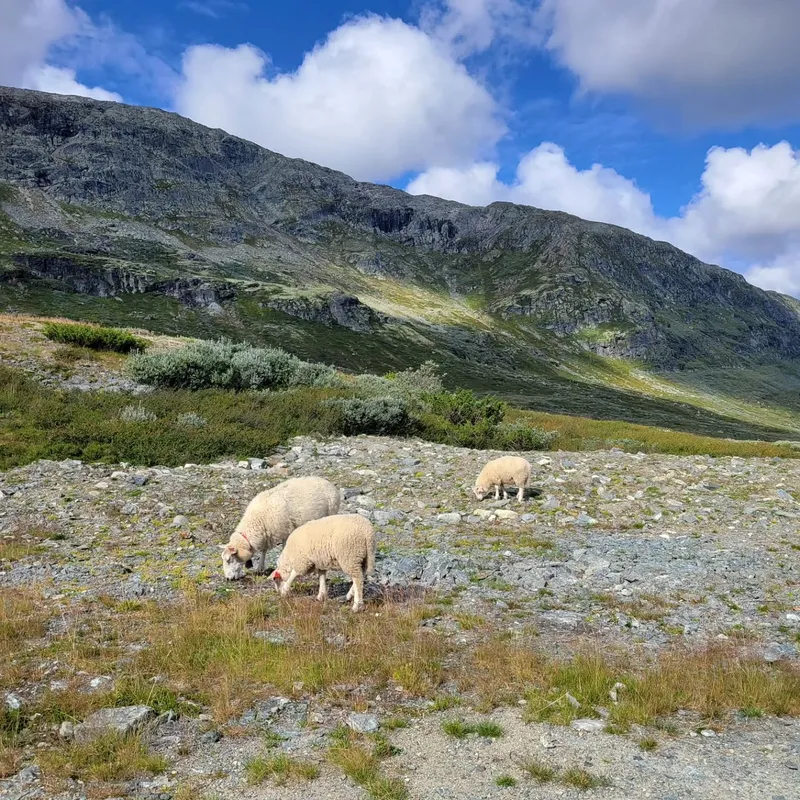
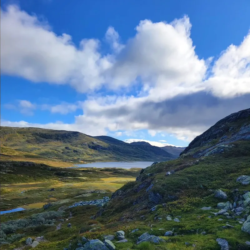
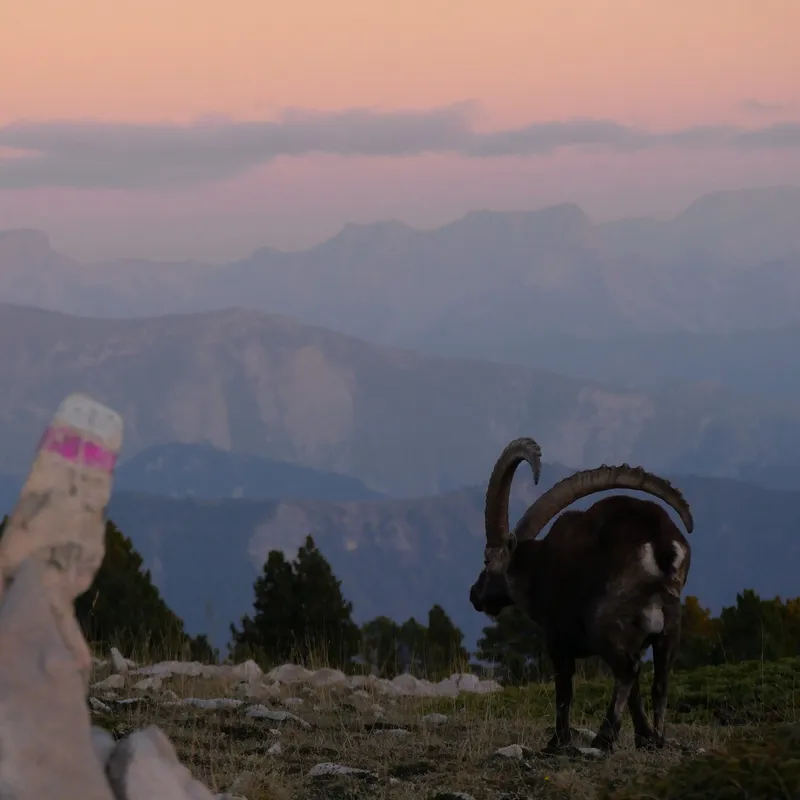
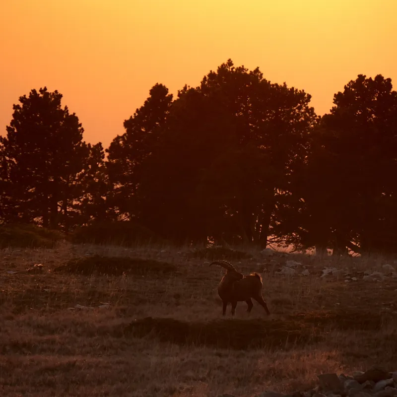
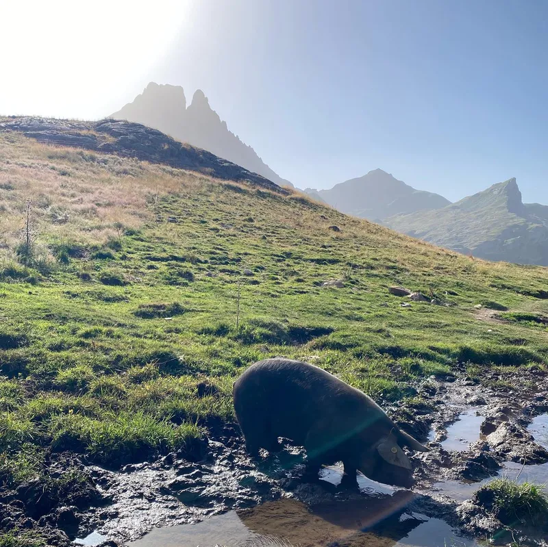
Today we left Jotunheim park to enter Skarvheimen. We said goodbye to our beautiful cabin after a delicious oatmeal preparation (only 160 NOK!) We say goodbye to our trekking neighbors, and goodbye to the flora and fauna of the park (we didn't get to see reindeers in the end...)
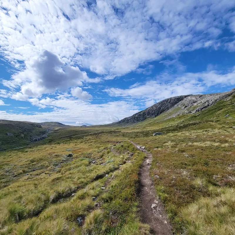
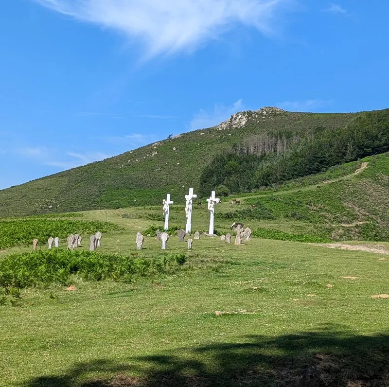
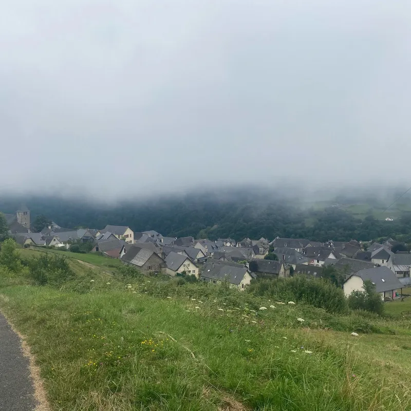
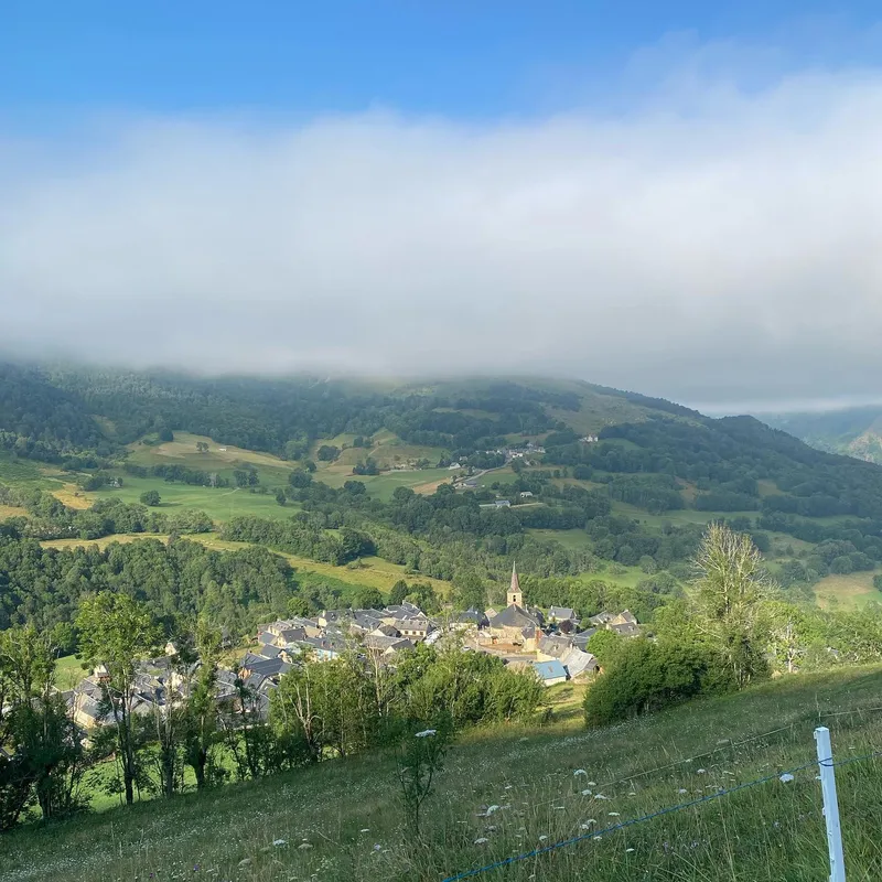
The weather quickly turns to a dry but slightly windy and cloud-less day — perfect for hiking — as we trek down repetitive sights of lakes and rocky paths. We're quickly glad as the altitude lowers to see some trees again, before eventually reaching a tiny village. There, we see an adorable little Scandinavian church (nothing like those we're used to) and meet a French girl doing Massiv the other way. We exchange insight on each other's future hikes and part ways after a 20min chat.
Coming the other way, things are very similar (the flora, the altitude) yet very different: The paths are consistently dry, very pleasant, and once we reach the top everything just has a little more color. We move on quickly, excited to reach the cabin, when finally, we notice 4 reindeers ahead of us. We take out camera and binoculars to observe them as they themselves observe us. Curious but cautious, they seem to, at times, come closer before running away.
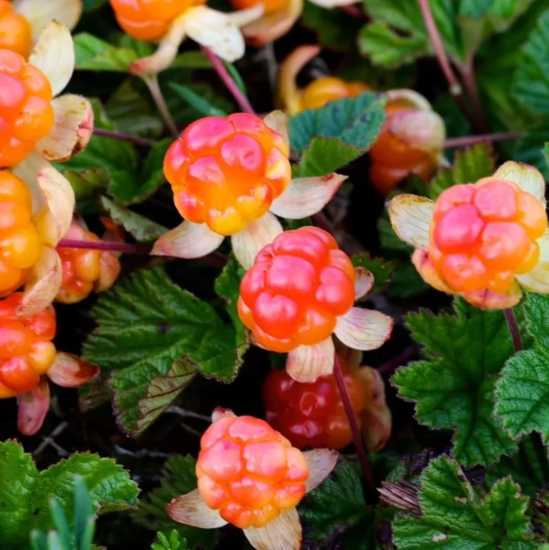
Upon reaching the cabin we meet people coming the other direction. They say reindeers are very common in this park, so hopefully, I'll get to snatch better pictures. Although this cabin wasn't as cute, it was next to a lake and a massive cloudberry field, so we picked a bunch of them and showered in the lake.
show lessSulebu → Skarvheim
 10 photos
 I (Ixil) noticed something about this hike: it's got the perfect amount of people on it. Sure, I had a mental breakdown in the Black Forest after seeing no one...
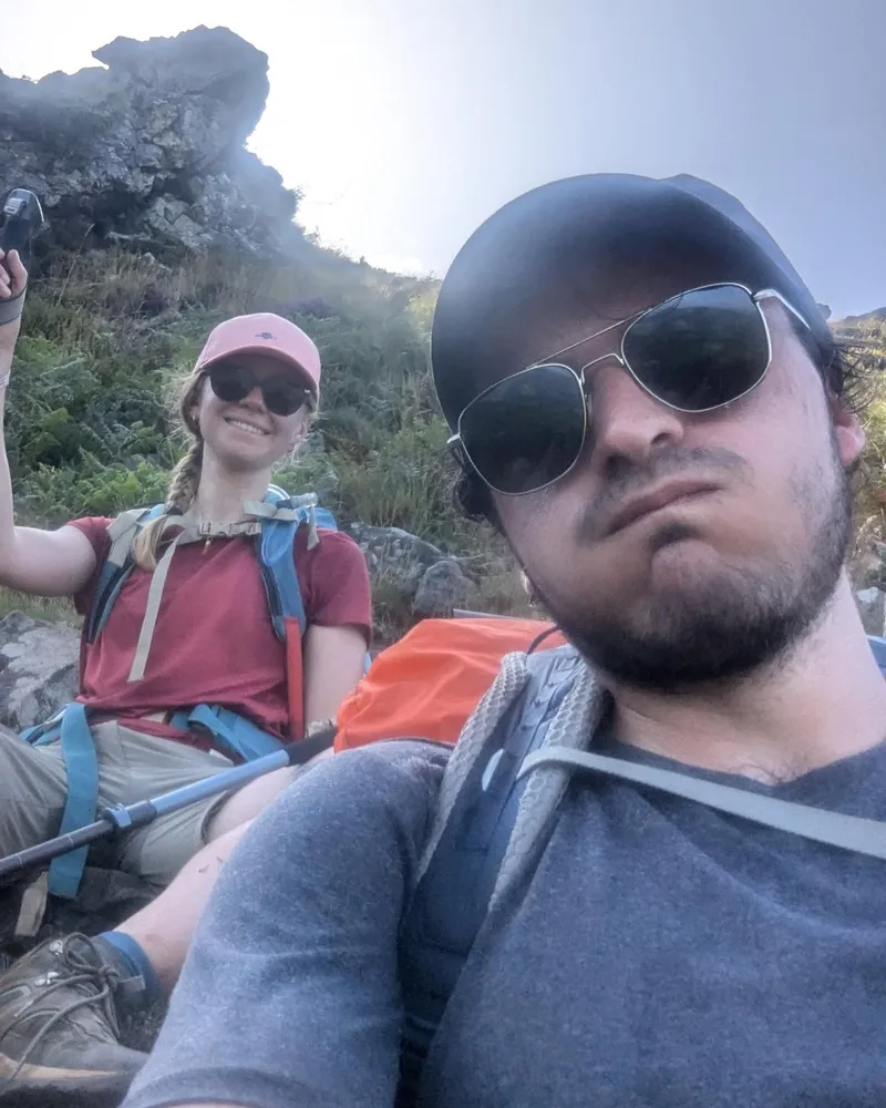
I (Ixil) noticed something about this hike: it's got the perfect amount of people on it. Sure, I had a mental breakdown in the Black Forest after seeing no one for too long, but I don't really like having to meaninglessly say "B'jour" under my breath 120 times a day either. Today, we met about 8 people. Some we just said "hej" but two couples we stopped and made small talk with.
It's mostly the same conversation: "You guys doing Massiv? — ye south to north. You? — ye same. — North to south? — well ye..."
And then exchange insights on each other's future terrain and cabins. But today, there was another topic added to the conversation: reindeers. We saw so many today. The first pack, I dropped my bag and roleplayed as a puma as I started crouch-running closer and closer for pictures, until I stood up and saw the entire pack run away.
Later, when we sat for meals, we noticed another two packs in view, taking our binoculars and observing, we slowly noticed them moving... towards us! I took out my camera for some shots from our hill overlooking the thing before turning right and staring back at a lone reindeer separate from the pack.
The cabin was the final highlight, fully furnished with sinks, warm water, flushable toilets, a shower! And yet somehow, no one else. We make soup as entree followed by pot-au-feu (also soup) and then a new desert: fruit soup. We didn't think this through very much, but it tasted great okay..?
show lessSkarvheim → Bjordalsbu
 8 photos
 Tiny transitional day today. One might be tempted to go a lil further but: 1. The cabin is really nice, 2. This area is mostly rocks for a while (bad...
Tiny transitional day today. One might be tempted to go a lil further but: 1. The cabin is really nice, 2. This area is mostly rocks for a while (bad for tent), 3. We heard talks of snow tonight.
So we're staying cosy. After making pancakes, we left at a late 10h40, and by 15h, we were done. We honestly expected worse. People kept warning us of the rocky paths in this area... but these people didn't hike the last two parks.
The cabin itself is built for winter sports, and is apparently quite popular in that season. There's enough bedding for 20 or so with extra mattresses stored. The ceiling is high, the kitchen wide, but this is not too overkill in summer, since today is the busiest cabin so far.
We saw our previous trekking neighbors again, but added to that a Spanish man and a retired kine turned DNT ranger, here to check the state of the hut. The man so far has spoken Norwegian, French, German, English, and Spanish fluently.
Slowly, 2 pairs of girls our age arrived (Dutch and German), and now one last older lady (very loud and chatty but funny). Apparently, the German girls — who also started in Sota Saeter but have thus far camped — have been noticing our names in the hut registries and seemed amused to finally catch up to us.
We ended up talking a lot to the girls, particularly Josephine, one of the Dutch, about various places we'd visited and their cultural differences. Great evening overall.
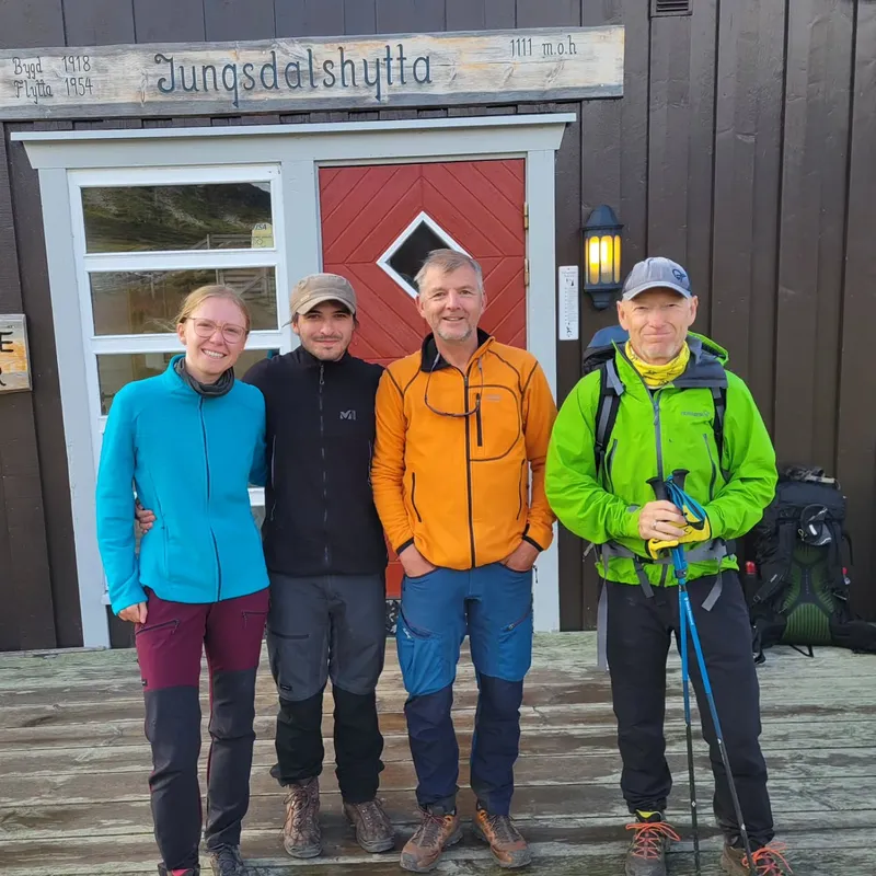
show lessBjordalsbu → Iungsdalshytta
 10 photos
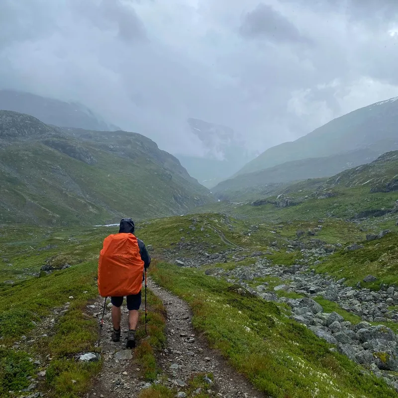
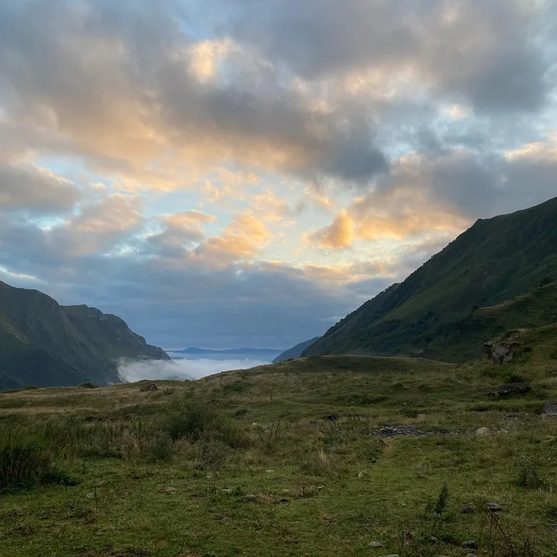
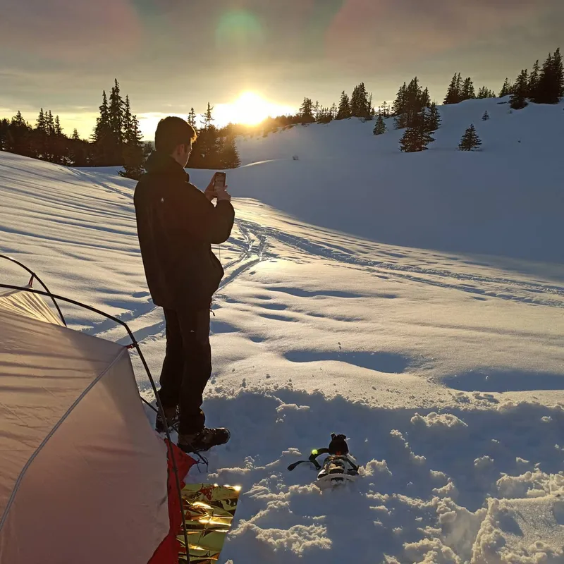
 Snow! Mathilde woke me up in the middle of the night after going for a wee (separate hut). The rumors were true: it was snowing hard outside. Happy but cautious,...
Snow! Mathilde woke me up in the middle of the night after going for a wee (separate hut). The rumors were true: it was snowing hard outside.
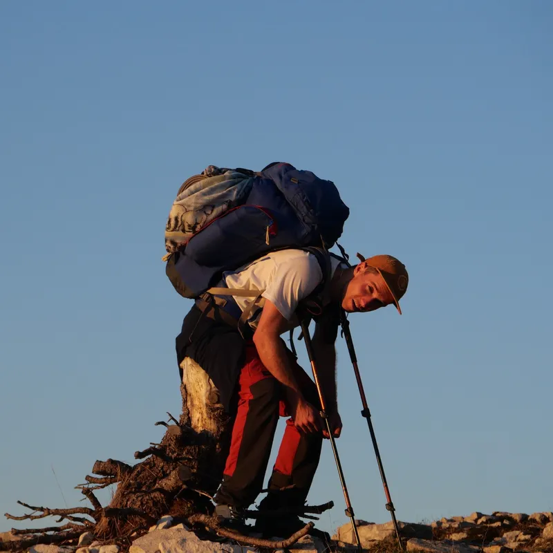
Happy but cautious, we eventually got up at 7am after so many warnings of today's tricky terrain. Our goal is to get to Iungsdals early so we can plan our post-trek adventures in a cosy serviced hut.
The chatty lady from the day before can be quite dramatic, and as we left she would exclaim oh how surprised she was we would dare leave in such conditions: "do you have a satellite phone with you?" "Personally I want to be able to go to the mountains again someday." Our German duo which we kept meeting along the day says she plans to hike up the nearby peak and call a helicopter.
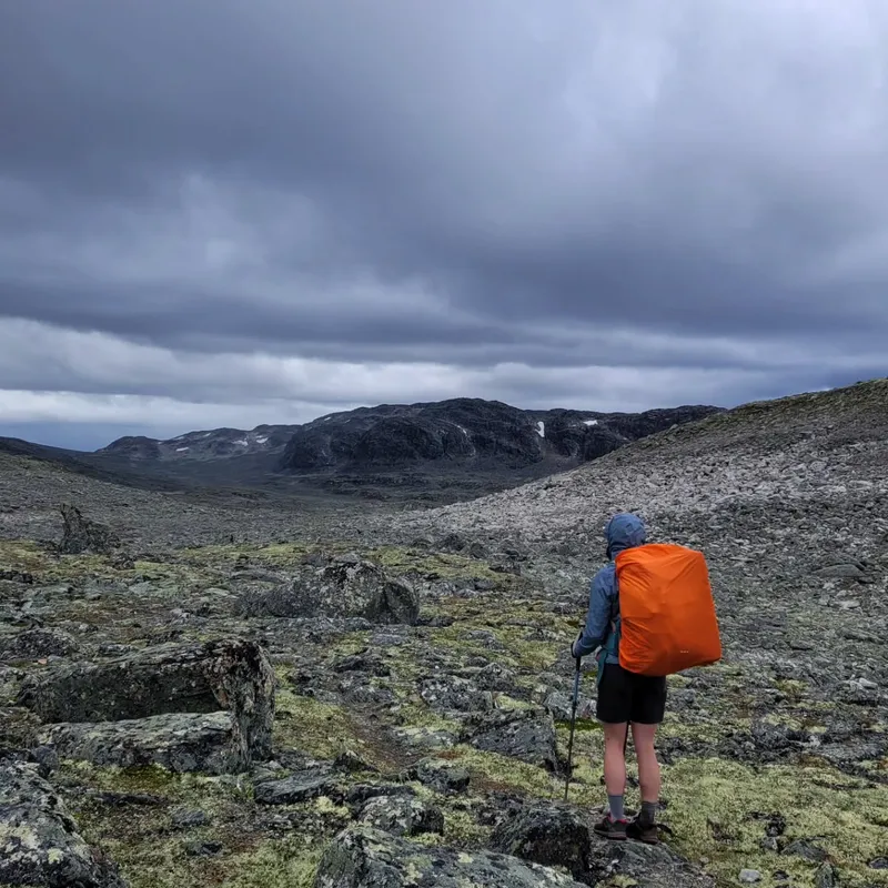
All of this was definitely excessive, and so were the rumors of exceptionally tricky terrain ahead. The rocky path was certainly rocky but even covered in snow, it wasn't so slippery. We quickly got past the rocks and into a grassy valley reminiscent of our alpine sights. The landscapes kept switching between gorgeous and gorgeous, surprising us at every turn with what might be the most pleasant hike thus far.
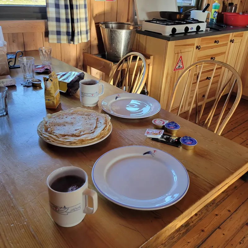
Once we reached the hut, we were forced to read and perhaps stress a little bit about how quickly we will have to book our train tickets, rent our car, and just figure out what to do in the next week. We bought candies, played guitar, read and showered. The dinner came with ingredients sourced from the farm, quite delicious.
show lessIungsdalshytta → Geiterygghytta
 8 photos
 Today was one of those days where you just feel like a mule, covering great distance mindlessly. The breakfast was more sociable than yesterday's dinner. We got to interact with...
Today was one of those days where you just feel like a mule, covering great distance mindlessly.
The breakfast was more sociable than yesterday's dinner. We got to interact with our 6 day long trekking neighbors for one last time (since we planned to tent tonight and not stay at Geiterygghytta serviced cabin). We take one last memorabilia with them: on the left, Lars, on the right, we don't know. In truth, we never thought to ask for their names, I just read it off a log book, but the second one has terrible handwriting. Let's call him Grumpy because he always speaks like he is Grumpy.
As we leave, we check the forecast for the day posted next to the reception. It predicts snow for the afternoon, and 0 degrees C temperature throughout. "Ah yes, I understand your concern." says Grumpy in his very dry Norwegian way.
But as always, the cold was manageable and a great motivator behind our 3.5km/h speed today. The snow did come and then went, but snow is much easier to handle than rain.
At the midpoint, we got to stay at a cabin where we met our German friends from the day prior and our Norwegian neighbors, most likely for the last time. We then kept hiking until finding a data tower, perfect for the planning we meant to do the day before.
show lessGeiterygghytta → Finsehytta

 10 photos
 What an odd last day. Doesn't feel quite as consequential as ending 33 days in the Pyrenees — in part due to the length but also knowing there's still a...
What an odd last day. Doesn't feel quite as consequential as ending 33 days in the Pyrenees — in part due to the length but also knowing there's still a week to spend here in Norway. Still, it was hard to say goodbye to our trekking neighbors after finally getting to really know them. We saw the Germans thrice today: first when they passed us as we were just waking up, second when we passed them as they were snacking against a cabin, sheltered from the frigid winds of today (which is when we snatched a picture.) The Norwegians were more elusive, but we were just as happy to see them in Finse where we all met one last time. Truly generous, Lars bought Mathilde and I a beer (alcohol is very expensive in Norway), and "Grumpy" gave us good recommendations for our remaining trip.
While in Finse we bought our train tickets, rented our car, shared a delicious "pizza" and dessert, and overall wound down from our adventures.
The day speaks for itself. The sights were a "best-of" of sorts, showing us landscapes reminiscent of our entire trek, including sights we didn't think we'd see again of rocky glaciers and frozen lakes. Despite the low ascent, it was very steep, felt sporty, and like a good workout to end on.
We hitched our tent at the foot of a glacier, next to a lake. Tomorrow, we get up at 8, hike for maybe 30 minutes back to the train station where we will be taken to Bergen for some tasty food and hopefully a sauna.
show lessChartreuse Traverse
Chambéry → Grenoble
 10 photos
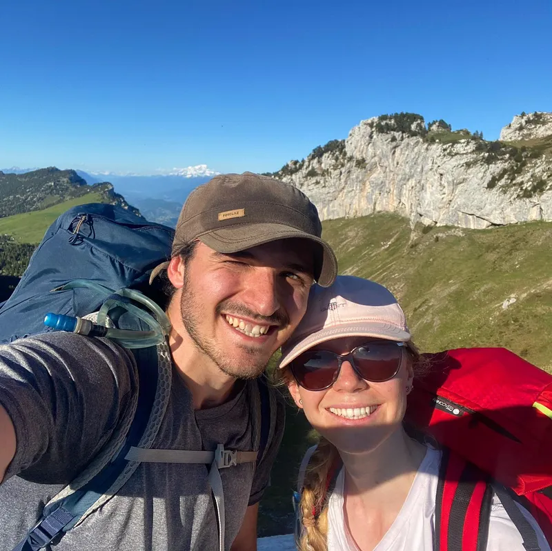
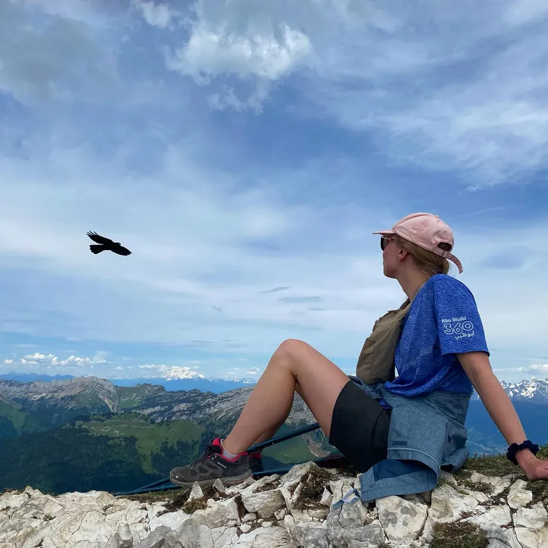
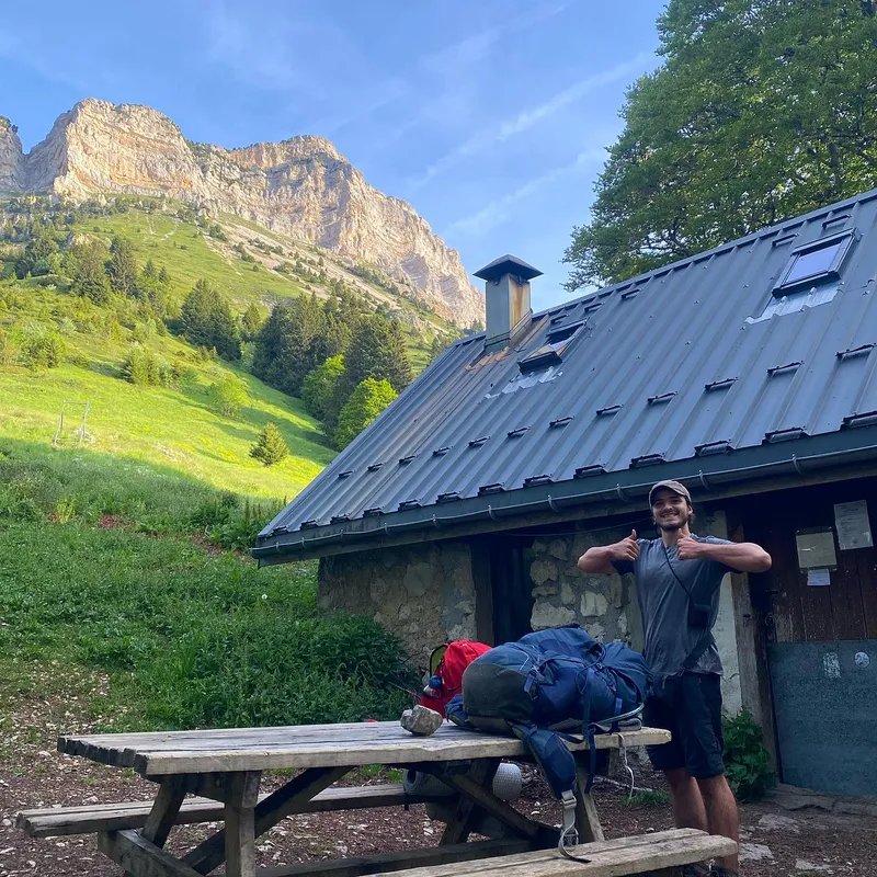
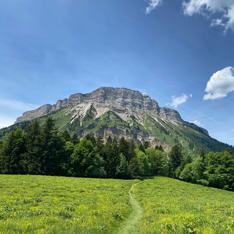
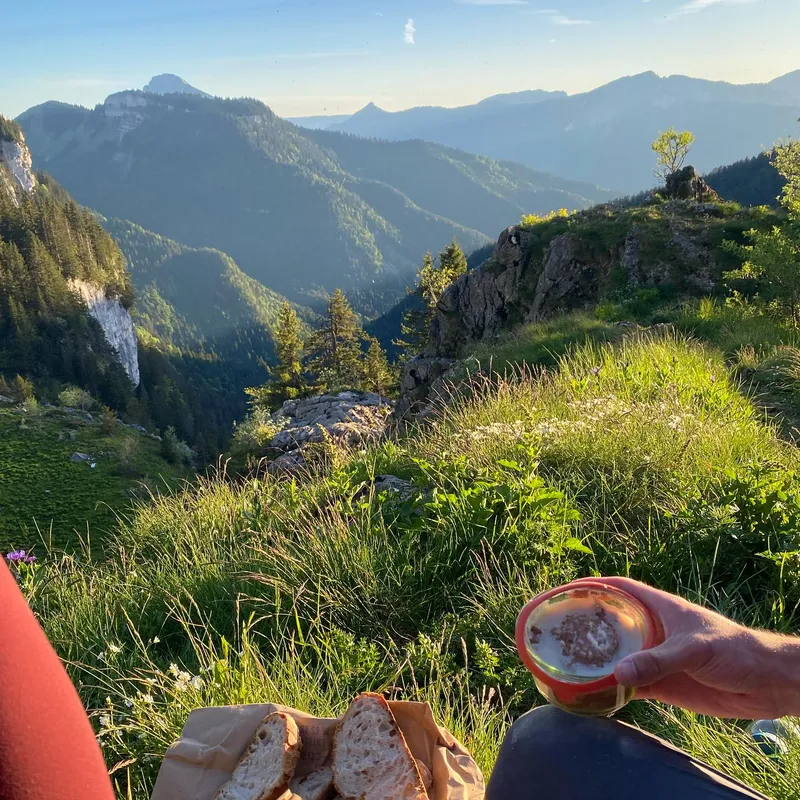
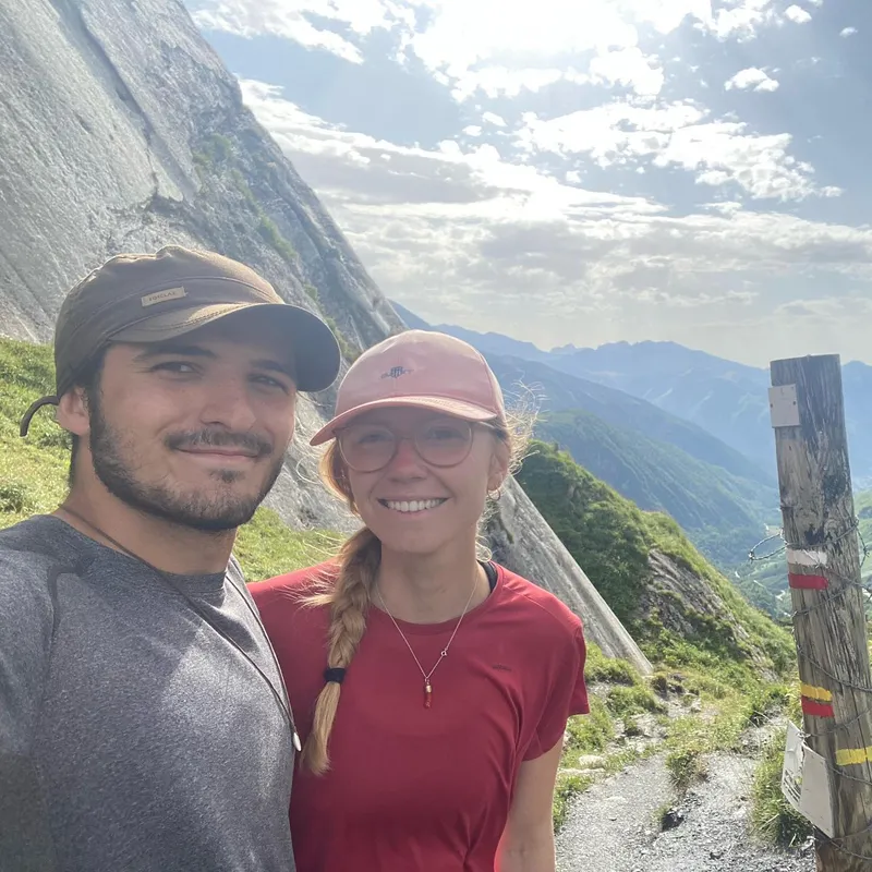
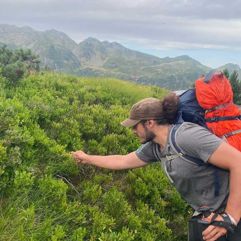
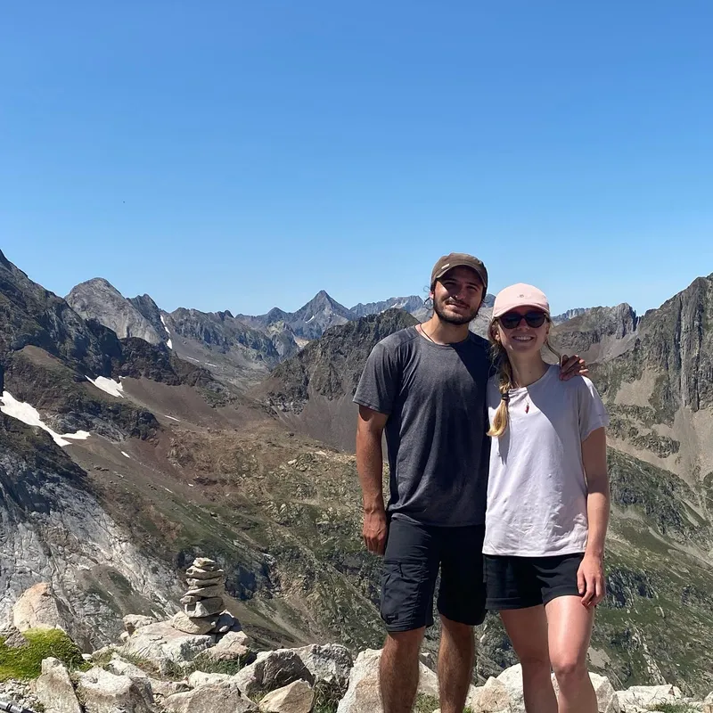
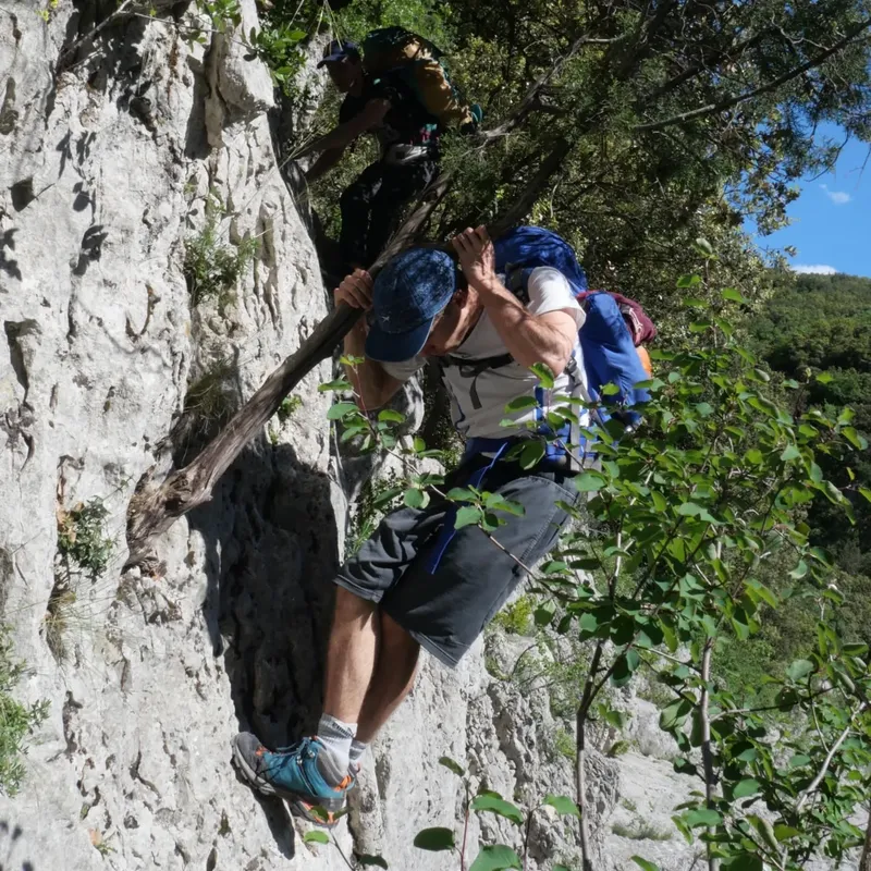
 The Grenoble trinity (Ecrins, Chartreuse, Vercors) is over (at least for Me [Ixil], Mathilde still needs to try Vercors.) This one is definitely a favorite, especially because of how accessible...
The Grenoble trinity (Ecrins, Chartreuse, Vercors) is over (at least for Me [Ixil], Mathilde still needs to try Vercors.) This one is definitely a favorite, especially because of how accessible it is while still giving you pure Alpine sights. You get to arrive by train, leave by train, without any of the usual hitch-hiking shenanigans.
I was worried the proximity to cities would taint the experience but, although it's definitely busier than the other 2, you still get to experience so much variety and nature. For us, this was also an opportunity to test ourselves ahead of our Norway trek, with some larger days than those in the Pyrennees.
If you want to do what we did, you'll need 2 full days, 2 half days, and big legs.
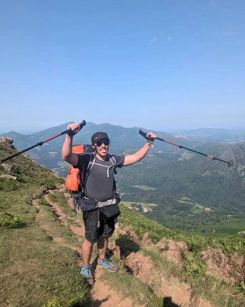
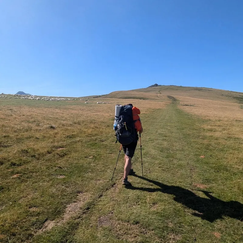
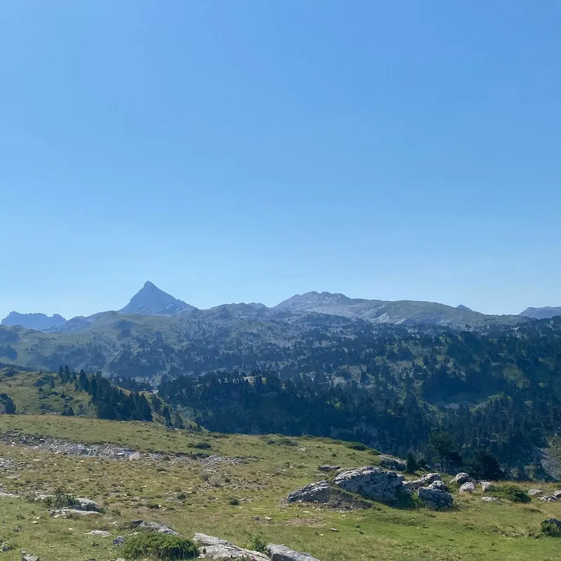
Day 1, Gare de Chambéry → Col du Mollard: 15.8km 1200m+ 170m- 4h40
Day 2, Col du Mollard → Cabane de Bellefont: 23.7km 1360m+ 1015m- 8h15
Day 3, Cabane de Bellefont → Habert de Chamechaude (with a bonus climb up Chamechaude): 20.6km 1010m+ 1095m- 7h10
Day 4, Habert de Chamechaude → Gare de Grenoble: 19km 570m+ 1900m- 5h15
show lessVercors — Autumn
Villard-de-Lans → Villard-de-Lans
 7 photos
 3 years ago I got frustrated with covid lockdowns and decided to try snow trekking in the Vercors. This kick-started a passion and lead to many adventures since. Last weekend,...
3 years ago I got frustrated with covid lockdowns and decided to try snow trekking in the Vercors. This kick-started a passion and lead to many adventures since. Last weekend, I went back there with @sr__leot to see what it looks like without the snow and ye: see for yourself. If you ever want to feel small and isolated but only have a large weekend to spare — if you want to experience trekking but are worried about large ascends — then the Plateau du Vercors will always be my first recommendation. Just go there already.
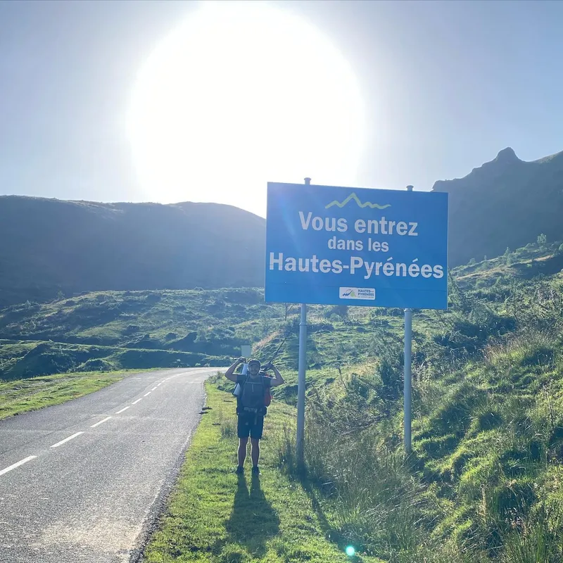
show lessGR10 — Pyrénées
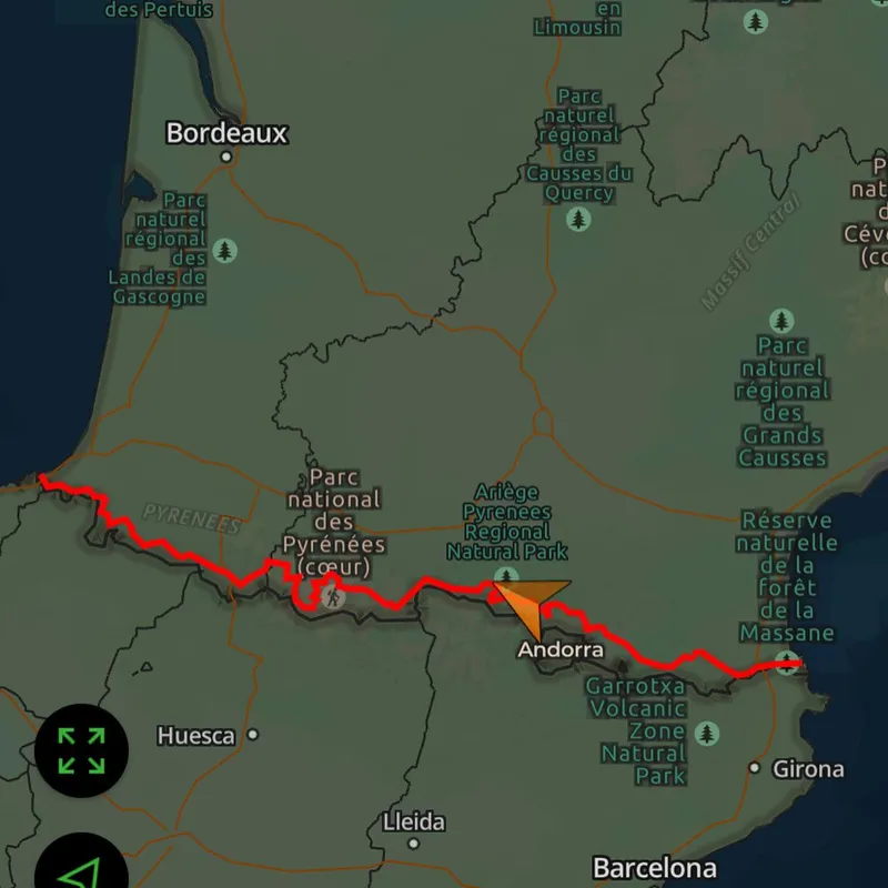
33 days across the French Pyrénées, Hendaye to Aulus-les-Bains. 599 km, ~37,900m D+.
Hendaye → Col des Poiriers
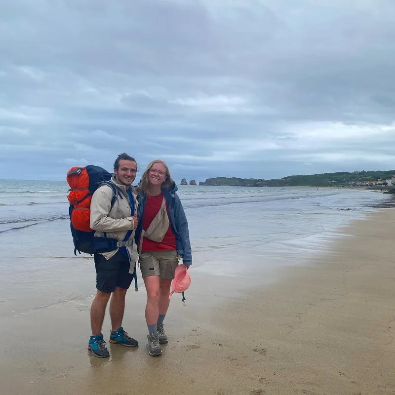
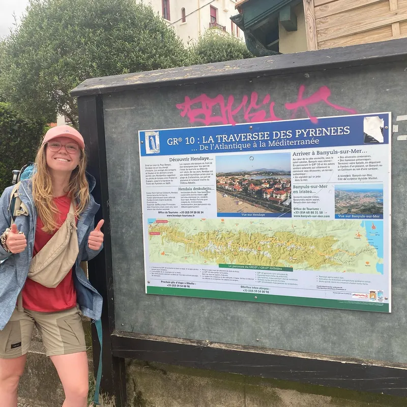
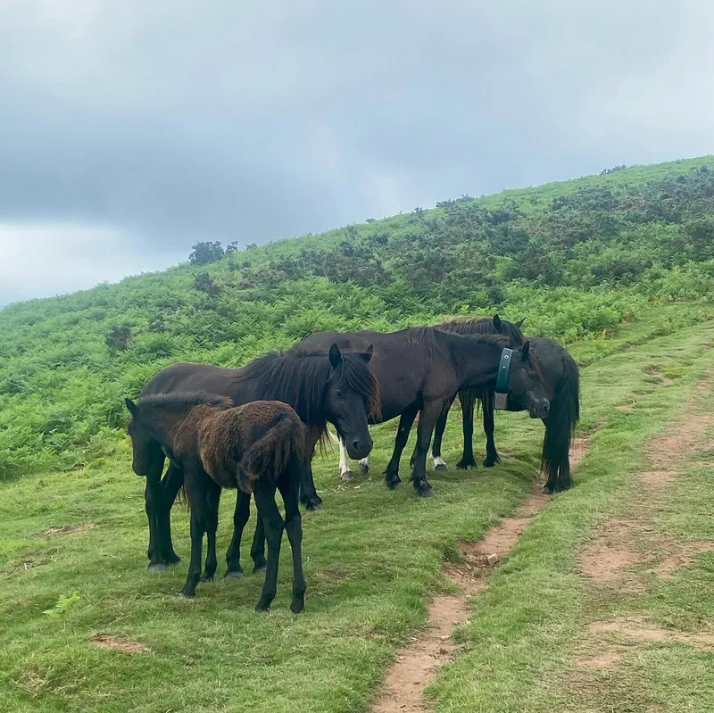
 5 photos
 Very short day to pick up the trek with, we started of losing a phone (it's actually fine now) and a water bottle. Still I (Ixil) got to do a...
Very short day to pick up the trek with, we started of losing a phone (it's actually fine now) and a water bottle. Still I (Ixil) got to do a lot of animal photography, saw a crow riding a black horse which I can't wait to share once I can read the SD card back home. This time of the year a lot of the animals are newborns which is pretty unique to see but also makes walking around them slightly more dangerous. Overall we made it well on time, still hangover from yesterday's fête de bayonne and rdy to go to sleep at 9pm.
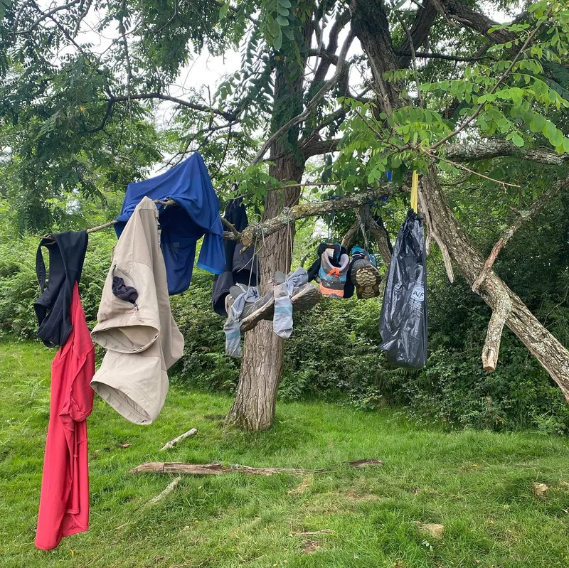
show lessCol des Poiriers → Les Trois Fontaines


 9 photos
 Perfect day if you don't account for Mathilde's water leaking in her bag and losing a sandal, and Ixil stepping knee deep in cow shit on his way to the...
Perfect day if you don't account for Mathilde's water leaking in her bag and losing a sandal, and Ixil stepping knee deep in cow shit on his way to the river.
All jokes aside it rly was a good day, did it in 2h less than planned. We seem to have trekking neighbors: 2 military guys around our age following the same route, and sleeping a few hundred meters after our spot. Makes for fun trek conversation.
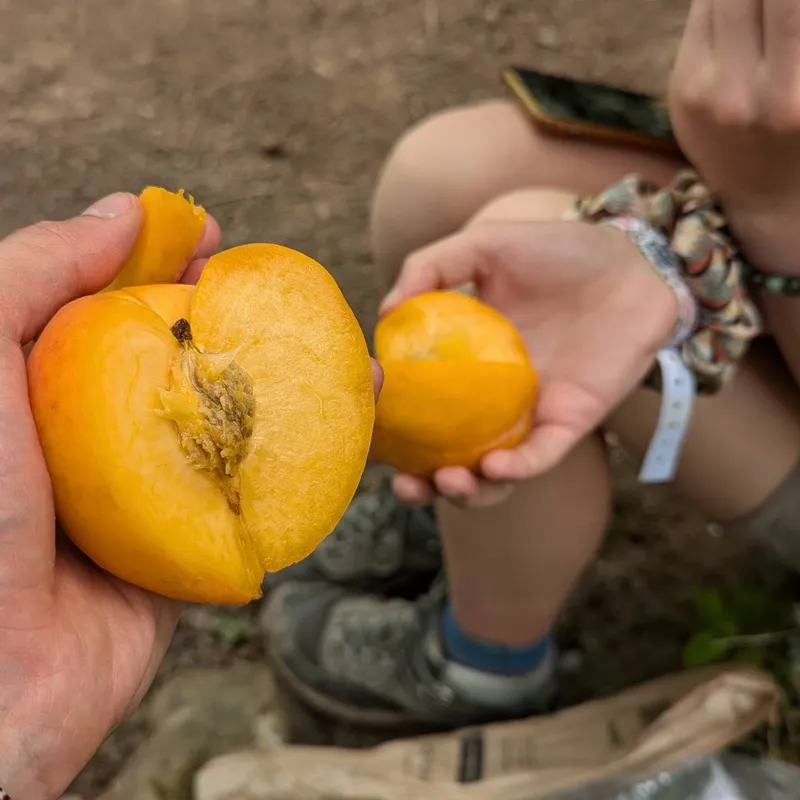
Finally we also got to refill at a surprisingly big Spanish mall on the border, which means cheaper food and new snacks to try (that massive apricot is actually a white peach and tastes like regular peach mixed with mango)
Anyways tomorrow we make it to Sare and refill for the next 2 days. Might have to save battery tho.
show lessLes Trois Fontaines → GainekoBorda

 7 photos
 Today is a Mathilde special, because we realize keeping only one phone alive a day is safer when only one battery decides to work, which means Ixil took all the...
Today is a Mathilde special, because we realize keeping only one phone alive a day is safer when only one battery decides to work, which means Ixil took all the pictures. Although this is a good way for her to relax, she's still surrounded by fractals (guess which) and saddle points (guess what). We're gonna need to keep hiking for a while before she stops thinking about maths.
Today, not much to be said aside from the end point at a beautiful and well equipped cabin, and also we had to pack food for 2 days, pretty sure our bags had 5kg added between the both of us. We're approaching more and more landscapes that look like the stereotypical Pyrenees, but while the sun made things look better, it also made our climbs much more painful and sweaty. We met a Father - Son combo along the way and made good conversation, they ended up camping next to us.
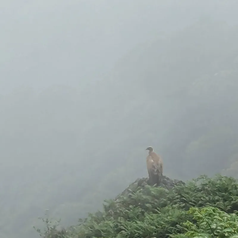
Also, the main avian we've seen so far has been the majestic vulture. You often recognize not just because they're huge (bigger than any falcon in the alpes) but also because unlike eagles, they move in groups. While bathing in the river and washing our hair we noticed 20 of them surge out of the woods all at once (very impressive.)
show lessGainekoBorda → Col d'Harrieta

 8 photos
 After a hellish way down, a hellish way up, the sun was scorching hot and I (Ixil) kept asking for breaks which, to her credit, Mathilde didn't need, all for...
After a hellish way down, a hellish way up, the sun was scorching hot and I (Ixil) kept asking for breaks which, to her credit, Mathilde didn't need, all for the wind and fog to show up once we camped. We were VERY worried water-wise because the camping location might not have any, in the end it did and we got to gorge in water and wash ourselves, but the doubt made us ration on the way up.
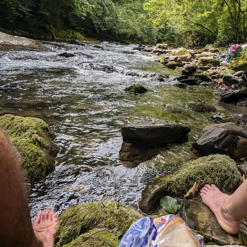
In-between these two horrors, a moment of bliss. We arrived at a village where we had promised ourselves a dip in the water. Leaving our phones behind to charge at a local library we left our bags with a restaurant and went down to the river. You'll have to believe me (since we didn't bring our phones) we had the most beautiful location, surrounded by waterfalls, plenty of depth to swim, the only truly pleasant moment of our day (that and the ravioli in the evening.)
show lessCol d'Harrieta → Col d'Arhaza
 4 photos
 Today, we woke up to fog, our clothes not at all dried from yesterday and smelling dreadful. We left off in said fog on our way up the col to...
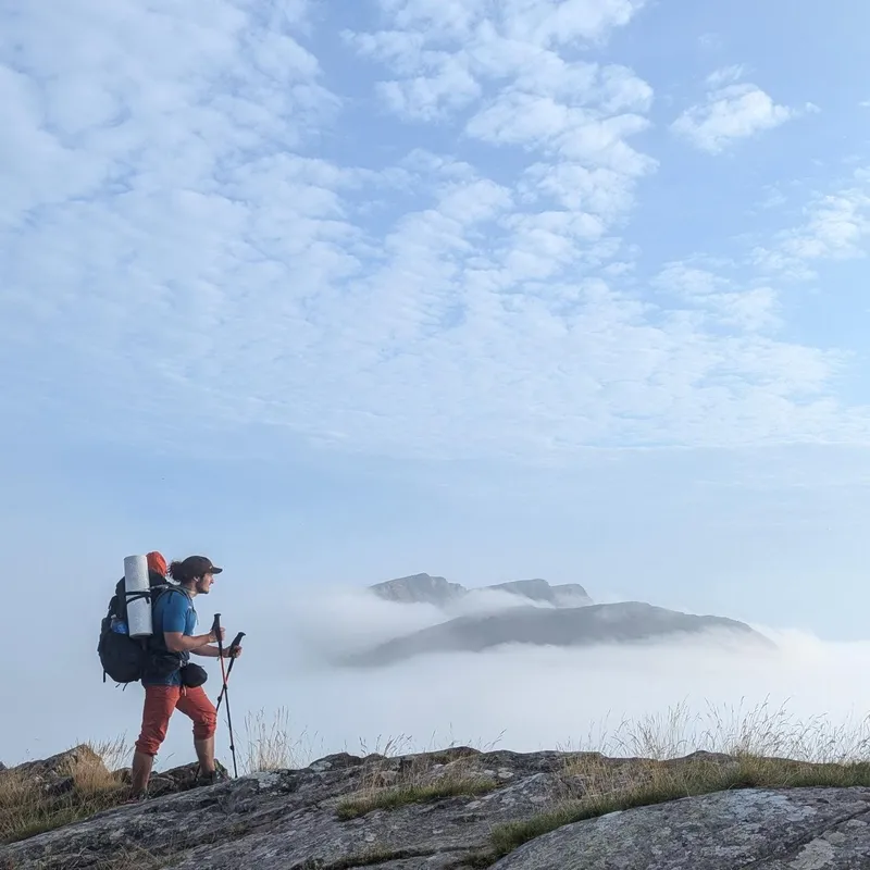
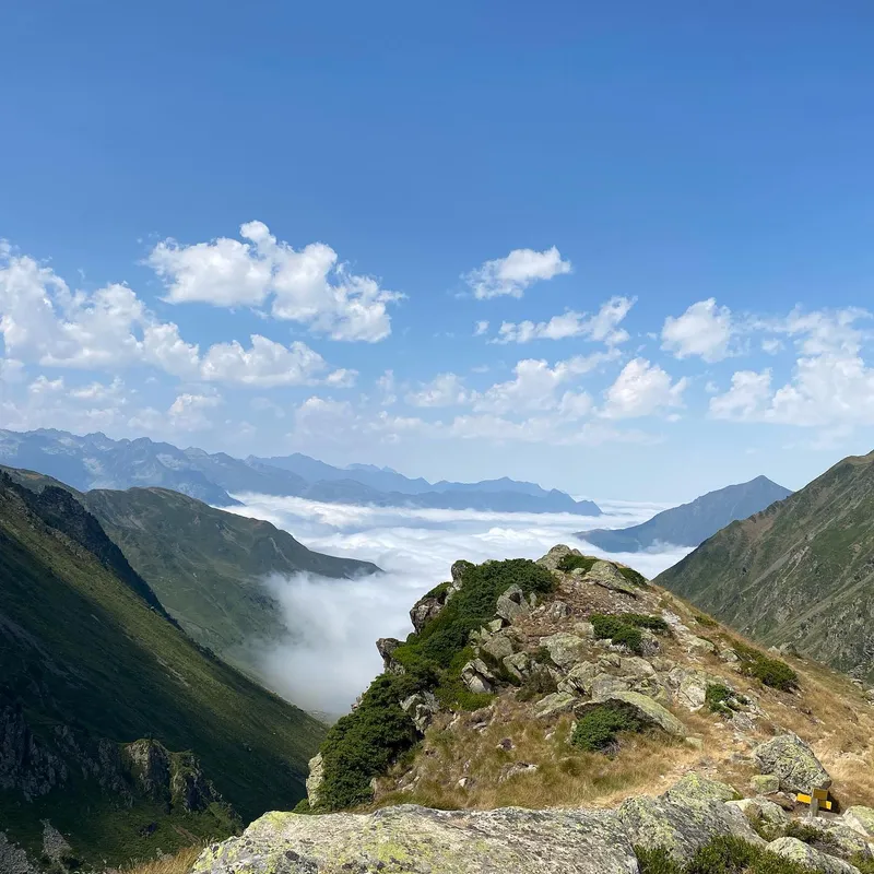
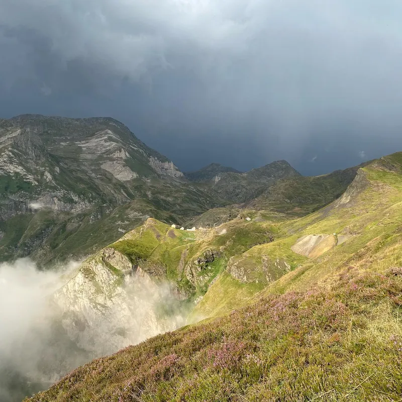
Today, we woke up to fog, our clothes not at all dried from yesterday and smelling dreadful. We left off in said fog on our way up the col to the nearby peak. Once we got there: bliss. The sun had yet to hit us and we found ourselves above a sea of clouds weaving left and right of the Crete, seeing clouds falling upwards above us. Purely the best view of the trip thus far.
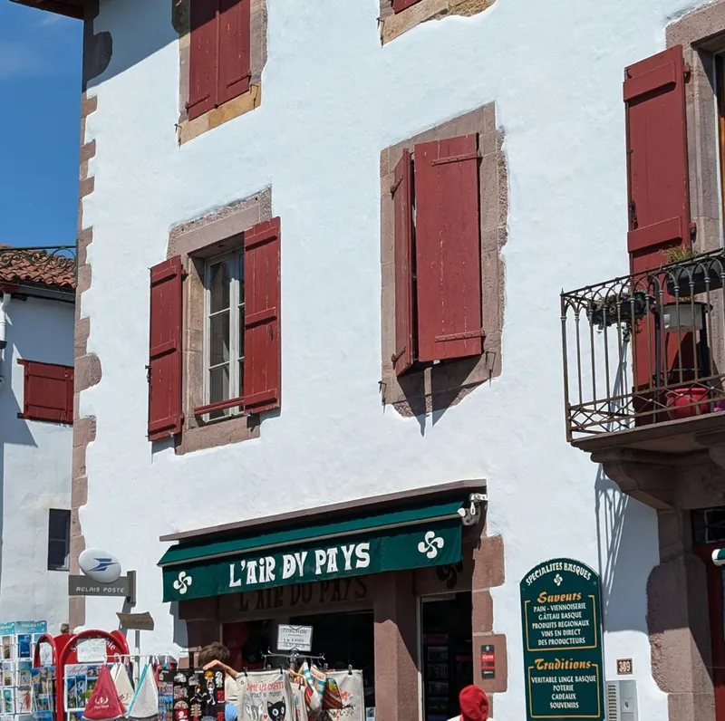
Once we got to St-etienne, we made way to an Intermarché and allowed ourselves orangina and schwepps, while using the available washing machines to get rid of the stench from our clothes. We then made way to the river where we saw families openly conversing in Basque, using French sparingly. Seeing what we thought to be a dead language alive and well was surprising, and happened again later in the day.
Finally we got to the col, we saw the two military guys that we kept on seeing and chatted for 30 or so minutes about our bags, our experiences thus far.
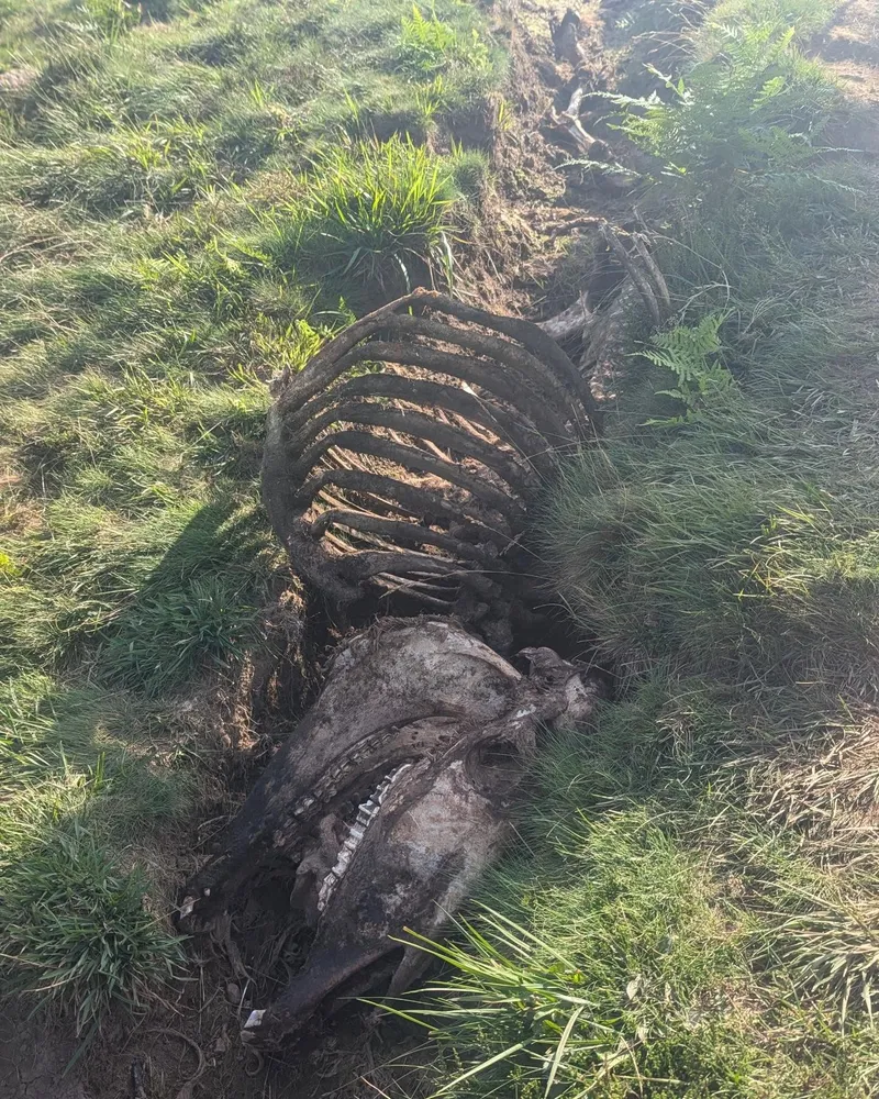
show lessCol d'Arhaza → Saint-Jean-Pied-de-Port
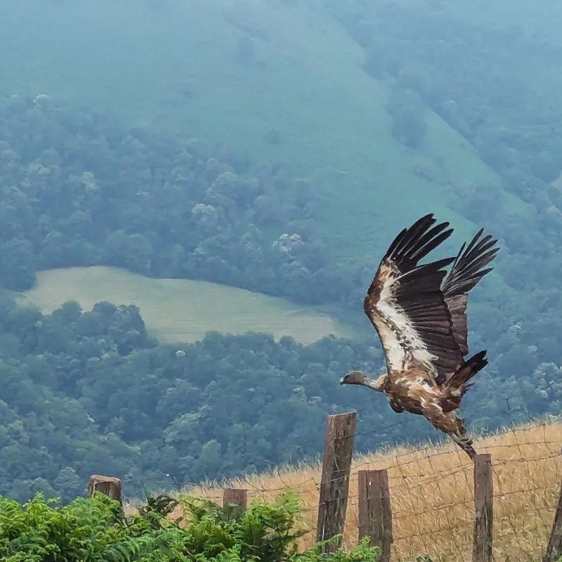
 3 photos
 Very easy day coming down the col to one of the first major cities, all in fog which meant no view but also no burning heat. We then elected to...
Very easy day coming down the col to one of the first major cities, all in fog which meant no view but also no burning heat. We then elected to stay at a camping in Saint-Jean-Pied-de-Port since we need water, phone batteries, and food for the next 3 days, and campings make all these things easily accessible.
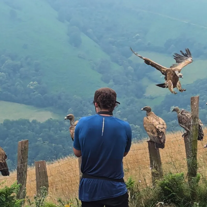
Overall this day WOULD have been inconsequential if it weren't for a stroke of luck: seeing a pack of vultures scavenging dead cattle. In the Pyrénées, to avoid rot, get rid of dead animals, and better control vulture populations, shepherds will leave their carcasses in designated areas. We did not know that was a thing until we saw 20 or so vultures rush down a leaving tractor and ran to the scene.
We also stopped for a game of pelotte basque and later tasted basque cakes which Mathilde surprised me with. Better get some of the culture before we leave their region.
show lessSaint-Jean-Pied-de-Port → Bordes d'Intzarazquie

 6 photos
 We woke up slowly, struggling to get the motivation. Mathilde was feeling rather sick to the point of puking, and so we considered staying in. But we couldn't waste perfect...
We woke up slowly, struggling to get the motivation. Mathilde was feeling rather sick to the point of puking, and so we considered staying in. But we couldn't waste perfect weather conditions (rainy but barely, windy but barely, cold but barely) after days of scorching heat, and we truly wanted to keep our off day for later, when the sun was high and the camping spot more isolated. So we decided to get up and hike out of town, warm up our legs and see how it felt. After napping in a field, we both felt better and willing to take on the full day, no shortcuts.
Although the light rain made it ideal for exercise, it meant the views were pretty average, not much to show therefore. Once we found a camping spot, we found there to be no data, hence the delay.
show lessBordes d'Intzarazquie → Chalets d'Iraty
 4 photos
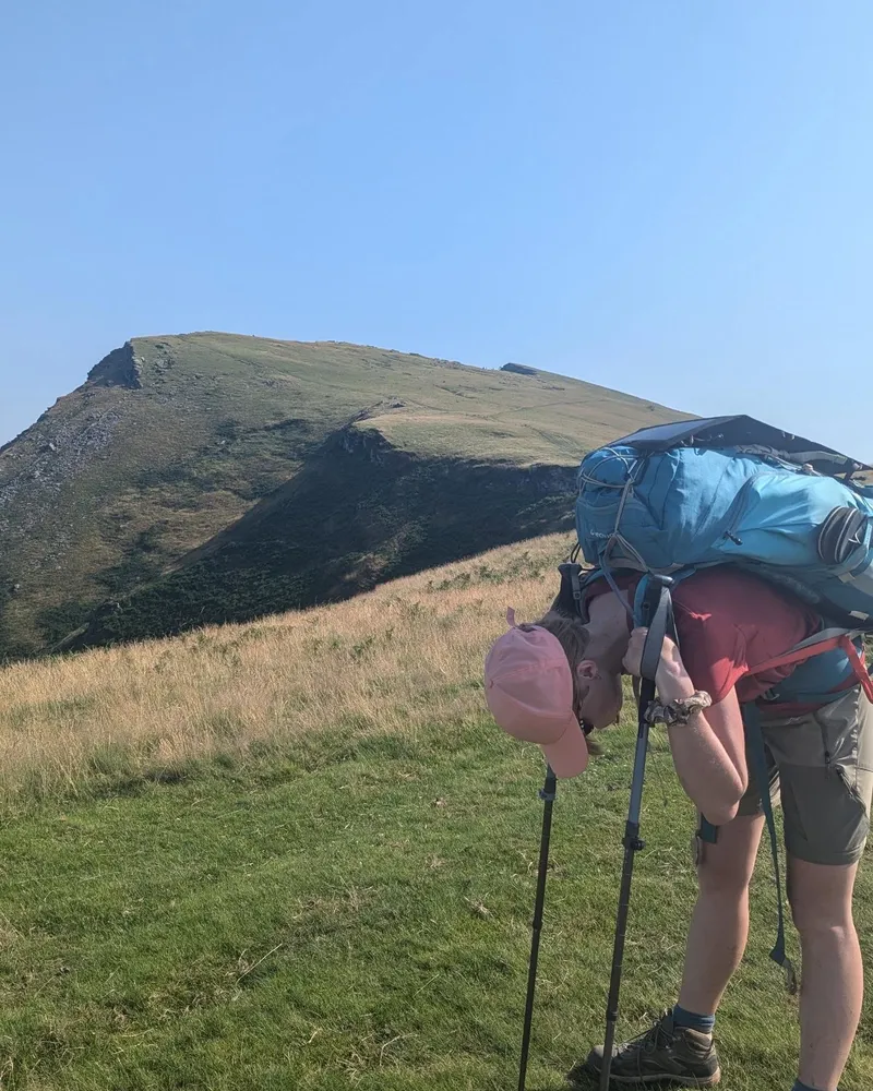
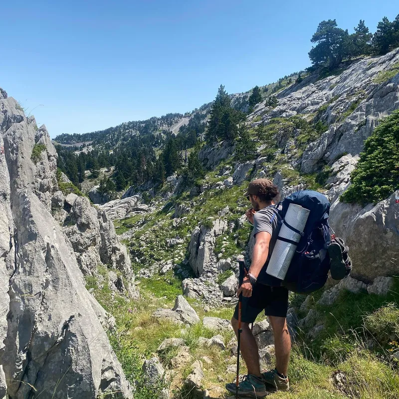
 Notice the dénivelé: the highest so far, and then the walking time: the lowest so far. This day had us worried for a while that it would be our most...
Notice the dénivelé: the highest so far, and then the walking time: the lowest so far. This day had us worried for a while that it would be our most technical hike up vertiginous walls, and yet these 1210m+ went up like a breeze, slowly introducing us to a new landscape and weather.
The sun's return was actually welcomed, with how moody and monotone the clouds were becoming. It meant putting on sunscreen again but was accompanied by a cold breeze which made it all okay.
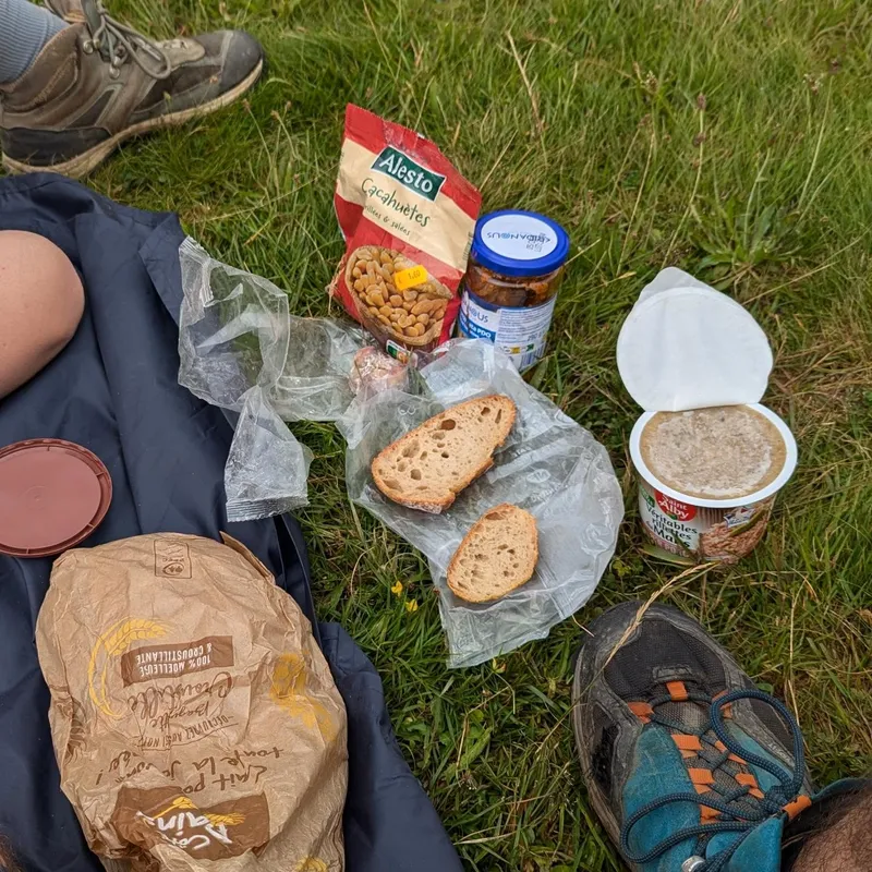
At their épicerie, we picked pasta and tomato sauce (the only cheap option) and spent carelessly on a brunch for tomorrow. Some of the luxuries include: a glass bottle of apple-grape juice; a very bitter Basque IPA; two tiny packs of candies; a knock off brand of Nutella called "Basquella".
show lessLes Chalets d'Iraty → Cayolar Olhadi

 6 photos
 The Pyrénées have a surprisingly tropical climate. In the morning, fog has settled down all around and only the lucky few who camped in altitude get to see the sea...
The Pyrénées have a surprisingly tropical climate. In the morning, fog has settled down all around and only the lucky few who camped in altitude get to see the sea of clouds from above. When hiking in the morning, we ended up seeing new landscapes through small ephemeral windows in the clouds, seeing only one peak, farm, river at a time in a beautiful danse.
After hiking 35min with Renaud (a man we had been seeing) and learning about his incredibly boring job selling industrial automation we eventually came upon a beautiful cabin near river Olhadi where we showered and refilled on water. Slowly more people joined: Ismaël, Cécile (an older woman doing the trek in the opposite direction, about 40 days into it), a couple of "new age" looking 30 year olds, and a family of mice and a bat.
With them we chatted about our adventures and equipment, made jokes, even shared food, until all going to sleep. In a shocking twist: Cécile was the loudest snorer.
show lessCayolar Olhadi → Sainte-Engrâce
 6 photos
 Today was a hard day compared to usual, mainly because of the clouds and fog that didn't leave us and blocked the supposedly nice views of the gorges de Kakuetta....
Today was a hard day compared to usual, mainly because of the clouds and fog that didn't leave us and blocked the supposedly nice views of the gorges de Kakuetta. Also we mainly walked on the road which is rough on the feet. I (Mathilde) have serious back pain which doesn't go away even though the legs are fine :/
Beyond that, we left at the same time as Ismaël and Renaud, hence it was nice to bump into them a few times during the day.
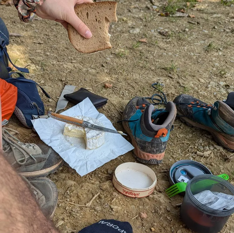
We learnt that the gîte could bring us to a small epicerie by car. The place was actually super cool, an old man is keeping it for hikers like us. There is everything you need, for cheap! Then a man ready to give up his 5 day trek offered us all his remaining food: coffee, noodles, snacks and even CHEESE! A MASSIVE BLOCK OF LOCAL CHEESE!
show lessSainte-Engrâce → Cabane du Cap de la Baïtch
 7 photos
 We wake up, 6am, ready to take on the single LONGEST day of the trek. A predicted 10:20 hours of walking ahead of us. My (Ixil) phone is dying one...
We wake up, 6am, ready to take on the single LONGEST day of the trek. A predicted 10:20 hours of walking ahead of us. My (Ixil) phone is dying one pixel at a time, everyone leaving decides for a shortcut but our pride won't allow. We give each other pep talks about how the next day will be easy and this is just something to go through.
And yet, a measly 7h is all it took us, setting up camp by 3:30pm. Not only that, this was by far the best day of our adventure yet. Sun? Yes, but also cold breeze all throughout. What we assumed to be a hellish hike up wet grass turned out to be a magical stroll through the Carribeans, followed by the typical view of wide hills over a sea of clouds, and, finally, a new landscape of small winding paths through mossy rocks, small pine trees and tall peaks in the distance.
Our photo doesn't do it justice, but google « Pierre de Saint Martin ». A gorgeous toblerone-looking mountain that our day centered around. Once we arrived a local told us things would only get better from here, we cannot wait.
show lessCabane du Cap de la Baïtch → Plateau de Lhers
 4 photos
 Today was a small day, with time for a « grasse mat », leaving camp at 9am instead of 7.30am and enjoying the view. For the first time, we didn't...
Today was a small day, with time for a « grasse mat », leaving camp at 9am instead of 7.30am and enjoying the view. For the first time, we didn't wake up in the fog and our tent and clothes were totally dry!
The hike started under blue sky above the clouds, then continued in the clouds, in a misty black and white landscape, before finishing underneath and finding « Lescun », a small village of stone buildings housing a strongly knit community.
There, we had time to buy food for the next 3 days and a baguette to accompany our cheese and Basque paté. We then said goodbye to the four people we had been seeing everyday for the past 3 days.
show lessPlateau de Lhers → Cabane de la Baigt de Saint-Cours
 8 photos
 Don't be fooled by the pretty pictures, today absolutely sucked. It could've been worst, forecasts had 34 degrees predicted, but 28 didn't feel too good either. After making it to...
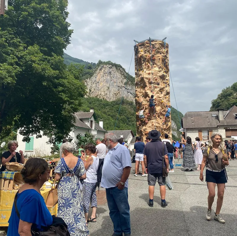
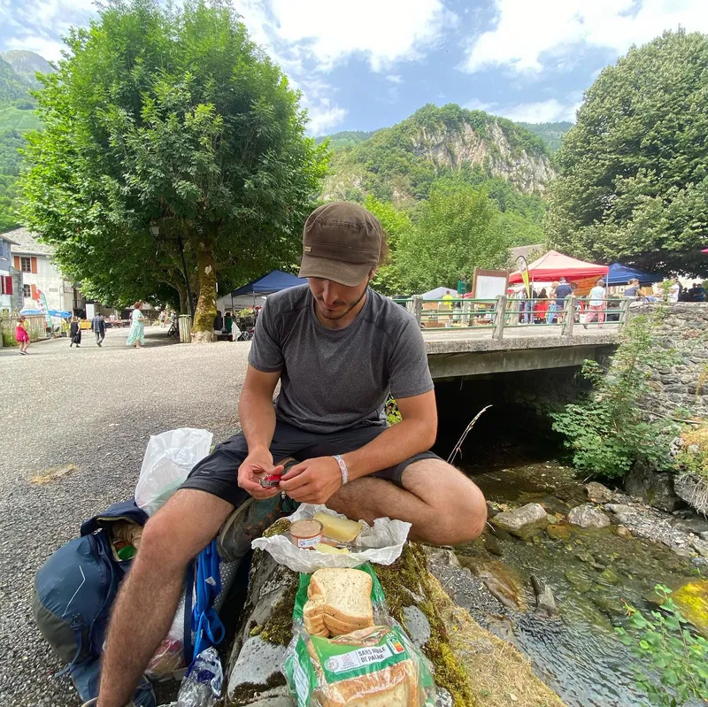
Don't be fooled by the pretty pictures, today absolutely sucked. It could've been worst, forecasts had 34 degrees predicted, but 28 didn't feel too good either. After making it to Etsaut on its yearly festivities (where we bought a thick almond paste steak) we began the climb along the hellish « chemin de Mâture ». A hike alongside a steep cliff where only passing winds save you from the burning sun.
And yet as always, once we arrived all doubt was gone. We found a makeshift village of tents around a crystal clear river where we added our house. Among the inhabitants some familiar faces, « the germans ». A group of two tall blond twins and one of their shorter girlfriend who we keep greeting in english.
The netherlands, they're from the netherlands...
show lessCabane de la Baigt de Saint-Cours → Plateau de Cézy
 7 photos
 Today was an amazing day! We woke up with a view on the valley and were able to hike for a few hours in the shade, with a cold breeze...
Today was an amazing day! We woke up with a view on the valley and were able to hike for a few hours in the shade, with a cold breeze to make it even better. Also, we saw (and smelled) a dead cow that was being emptied from the ass by a group of vultures.
At the col, the view was one of the best we had so far, with lakes, mountains on both sides and the Pic du midi d'Ossau far away. It seems to be a famous hike as there were many people climbing up when we were going down running like for a trail. Felt good.
We were having a fun evening with the Dutches until the sheperd came and screamed at us for showering. We ended up the night with pasta and tomato sauce (again) and for some reason it still tastes super good! Oh, we also got invaded by donkeys who wanted our food, but Ixil managed to make them go to the Dutches' tent.
show lessBivouac de Cézy → Vallée d'Arrec d'Arbaze
 7 photos
 I (Ixil) have a theory: the deciding factor for whether a trek day is good is the campsite and meal. The worst day will be saved by a good camping...
I (Ixil) have a theory: the deciding factor for whether a trek day is good is the campsite and meal. The worst day will be saved by a good camping spot, the best day ruined by a bad one. This is why after making it up 800m and down 1000m to Gourette in 4h30, and finding only a pretty ugly ski station with a campsite next to a parking lot, we decided to keep going.
In accordance with my theory, we decided to buy a melon. Yes it would be heavy, but who cares what pain you feel on the way up if it means a better meal?
There is something we had not accounted for. One of the forecasts for the day had a small storm in the afternoon. We found ourselves hiding under a rock for an hour, completely moist and hating ourselves. And yet, once the storm has passed and our tent is set up in complete isolation next to a calming stream, all is forgiven.
show lessVallée d'Arrec d'Arbaze → Lac d'Estaing
 6 photos
 Lord forgive us for we have sinned. After a beautiful slow morning and a sunrise, we make our way to Arrens where we refill on food ahead of our OFF...
Lord forgive us for we have sinned.
After a beautiful slow morning and a sunrise, we make our way to Arrens where we refill on food ahead of our OFF day 2. We eat our best lunch yet: ham and cheese sandwich followed by ham and melon.
Now imagine yourself, two hours after your legs have rested, with nothing on your mind but the delicious brunch and rest ahead. The temperature has slowly risen over 30 and simply standing out of shade makes your skin moist with sweat. Ahead, 10km of pretty uninteresting road connecting the village with a popular lake, 10km which until now you believed to be only 3. And the whole time you remember: there's that bus connecting Arrens and the lake in under 30 min...
What would you have done?
show lessLac d'Estaing → Pont d'Espagne
 6 photos
 Very challenging day. Not because of the 1100m ascend we started with - no, that we were done with in 2h - nor was it the 1450m coming down. No...
Very challenging day. Not because of the 1100m ascend we started with - no, that we were done with in 2h - nor was it the 1450m coming down. No as always, it was the weather. We were lucky enough, we knew there would be a storm but we at least made it to Cauteret in time.
Despite how easily the 1100m+ and first 14k were, it was the last 500m+ and 6k that were the most frustrating. Picking the wrong routes, struggling to decide which layers to keep on or off, whether to take the paved road or forest path. In the end we made it fine and found a warm shower and well equipped room with free camping.
show lessPont d'Espagne → Cabane de Lourdes
 7 photos
 Notice the top elevation, this is the highest point of the whole GR10, but there are many more superlatives for today. The Pyrenees marmotte and Alpes marmotte are one and...
Notice the top elevation, this is the highest point of the whole GR10, but there are many more superlatives for today.
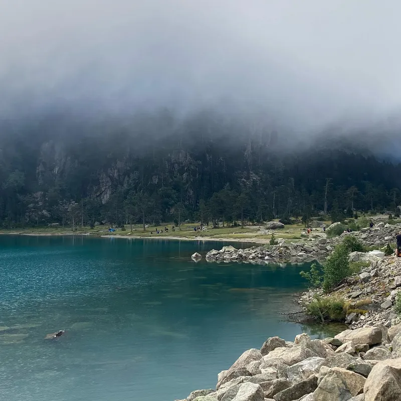
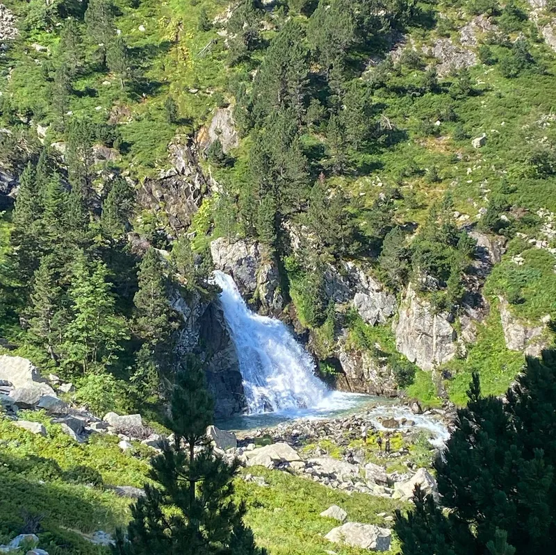
The Pyrenees marmotte and Alpes marmotte are one and the same. The one we see here was actually imported from the Alpes, and yet their behavior is vastly different. Never in my life have I seen so many marmotte in a day, from so close, and so fat. This made for great pictures, especially with a large scrumptious marmotte under a refuge who would pose and model for all passer-bys.
Speaking for myself(Ixil), this may have been the best hike I have ever seen. The views were heavenly, every river called for you to swim in it. As we climbed up to the first lake the fog slowly withdrew and revealed a scenic beach full of campers packing their tents. Everything after would outdo what came before from the giant waterfalls to the colorful fields of flowers with their smell. To give you a better idea, Mathilde's main contention was that it may have been at times « un peu trop paradisiaque ».
show lessCabane de Lourdes → Gavarnie
 5 photos
 Soooooo Mathilde puked more last night, starting to think this wasn't the candies after all. She couldn't get up in the morning until pretty late so we hatched a plan:...
Soooooo Mathilde puked more last night, starting to think this wasn't the candies after all. She couldn't get up in the morning until pretty late so we hatched a plan: go to Gavarnie (the next city) and take a rest day.
The timing was extremely lucky, because the hike to there was the flattest and easiest there ever was. We stopped at a refuge. The rooms were too expensive so we chose the tents but the owner pitied her enough to leave her a bed for the day to rest in.
Tomorrow I will wake up and hike solo (first time ever surprisingly) to Luz. Mathilde will wake up later and take the bus to that same location.
show lessGavarnie → Luz-Saint-Sauveur
 7 photos
 Today Mathilde took the bus to Luz while I hiked there. Since Mathilde wasn't there to tell me how stupid and reckless it is, I got to do my favorite...
Today Mathilde took the bus to Luz while I hiked there. Since Mathilde wasn't there to tell me how stupid and reckless it is, I got to do my favorite thing: run downhill like a maniac hoping my legs, shoes, and the floor don't betray me. I felt like a trekking machine, rushing past others with my large bag.
Eventually I was stopped by a park ranger. He's with the rescue team, looking for a 70 year old man called François, his wife hasn't heard back from him. Showing me a picture of the man on his phone, I recognize the refuge from last night. Suddenly, the helicopters swirving above me take on a grim meaning, and I subtly slow my step from then on.
After days of paté, nutella, candies, and to help Mathilde's belly, we offered ourselves a warm vegetable soup with yogurt, fruits and tomatoes.
show lessLuz-Saint-Sauveur → Lac d'Aubert
 9 photos
 What a day! We didn't need to go to Barèges for groceries, so I(Mathilde) found a shortcut. It had the same elevation, but fewer kilometers. This decision was both the...
What a day! We didn't need to go to Barèges for groceries, so I(Mathilde) found a shortcut. It had the same elevation, but fewer kilometers. This decision was both the best and worst (but still the best in the end.)
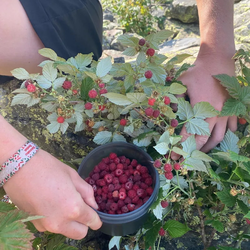
Best: We traversed a field of wild raspberries and HAD TO stop to gather a full tupperware. We hiked in a beautiful valley with fewer people and a more peaceful hike. We met a cheerful girl from Quebec who does the Hexa trek.
Worst: After lunch, we realized that the hike was mainly walking on rocks, with no specific paths except a few kerns. It quickly became a climb (4b to 5a but with a 20kg bag.) My phone's charger broke in Ixil's pocket. With my phone having 6% battery, we felt completely stranded and considered going back. However, we managed to reach the top (which is now officially the highest point on our trek) and finally got down to the lake arriving at 8.15pm. This is the kind of day you hope to see once in such a trek, even though we were at times reckless.
show lessLac d'Aumar → Bourisp
 7 photos
 This might be our record for speed. After being woken up by sudden rain at 6am, we hiked out to scenic views by the lake. We saw an odd looking...
This might be our record for speed. After being woken up by sudden rain at 6am, we hiked out to scenic views by the lake. We saw an odd looking building near it, all alone yet accessible by road and surrounded by crystal clear reflections on the water. All in all this would be the best writer's retreat in the whole world.
After this, it was all downhill. As in we hiked down 2000m. We stopped for overly expensive orangina and ice cream, and then back to trail running down 1500m to Bourisp.
On our way down we discussed our best days, best meals, best encounters. This could be the best dinner anyone's ever cooked out of a jetboil: instant noodles with turkey breasts, coconut milk, canned mushrooms and the spice packs from the noodles.
show lessBourisp → Cabane d'Ourtiga

 7 photos
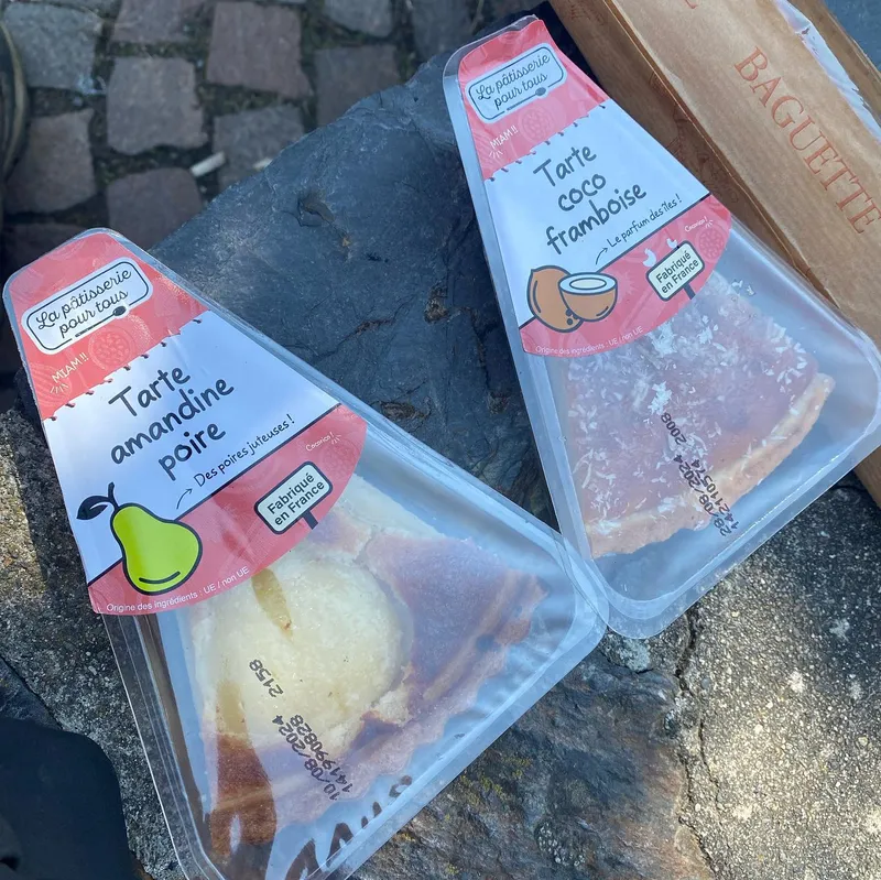
 Today was a transit from Bourisp (civilization) up to the mountains. In Loudenvielle, we refilled for the next two days, being a bit more reasonable with candies, except for 2...
Today was a transit from Bourisp (civilization) up to the mountains. In Loudenvielle, we refilled for the next two days, being a bit more reasonable with candies, except for 2 cakes « poire amandine » et « coco framboise » for lunch.
The climbs were steep and the weather hot, probably the reason why people we crossed kept saying « good luck ». In the afternoon, we reached a valley where you don't see any village and planned to sleep in a cabin. Unfortunately, a family of 6 were already there using all the beds. These types of places are usually meant for hikers to sleep, not big families on day trips. Sharing these with other trekkers is part of the deal and usually the most fun.
show lessCabane d'Ourtiga → Cabane d'Espingo
 10 photos
 It's 2:30pm, we've already arrived and couldn't be more pleased. We see a lake, no tents in sight. I take a dive. We read. We then take out four sugary...
It's 2:30pm, we've already arrived and couldn't be more pleased. We see a lake, no tents in sight. I take a dive. We read. We then take out four sugary crêpes and garnish them with brownies (the first « brow-crêpes ».)
By 11am we make it to Granges d'Etsau. Upon arriving we find a Wallmart-sized parking lot filled to the brim. To our greatest surprise: they sell 6 sugary crêpes for 3.50€. We eat 2 and pack the other 4 for the night.
The whole time we cruise past hundreds of tourists. Each lunchspot, landmark filters more of them away until we find ourselves on our beach, nearly alone. Finally I head to the nearest refuge when I recognize a familiar figure from behind... the fourth dutch! He promises to send the others' info.
show lessCabane d'Espingo → Bagnères-de-Luchon
 6 photos
 This is D-1 of us entering the doom zone. Tomorrow we enter the Ariégeois pyrennees, and 4 days of walking with no obvious way of resupplying. Like the final boss...
This is D-1 of us entering the doom zone. Tomorrow we enter the Ariégeois pyrennees, and 4 days of walking with no obvious way of resupplying. Like the final boss in a video game. Our only solace being a refuge on the 5th day where we promised ourselves a warm meal.
With our experience so far, we packed the best compromise between price, weight, packability, and calories. It cost 52€ for 2, weighs around 6kg, and should feed us plenty while offering variety.
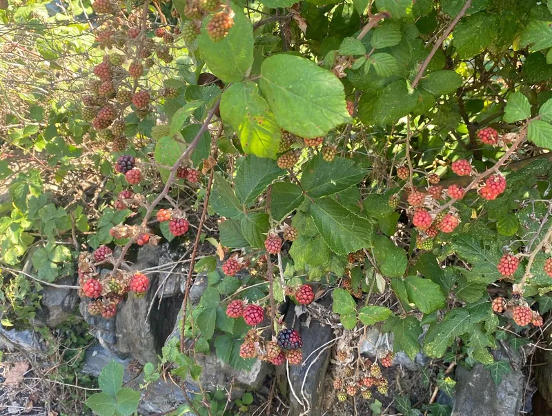
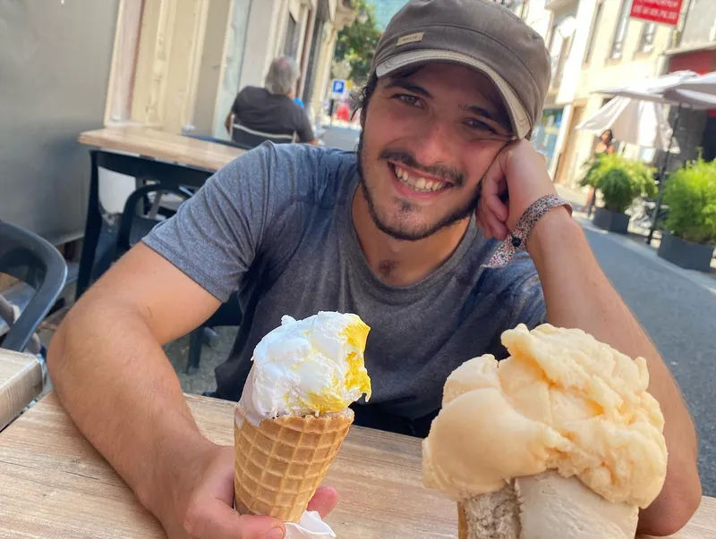
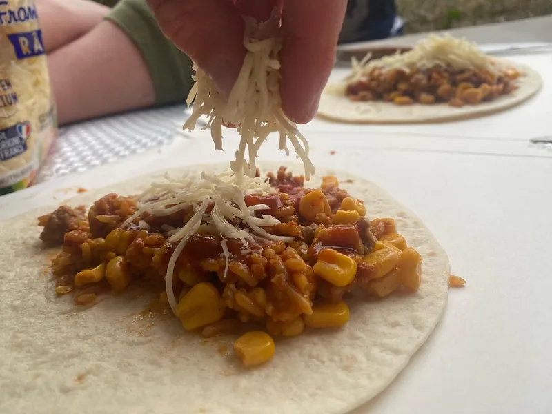
We met Giel again and a new trekking partner: Guylaine. We sat down and shared lunch for a good hour. Saying goodbye to Giel leaving tomorrow for Bordeaux. To gorge on calories we stole blackberries from a garden, stopped for icecream and successfully improvised ourselves burritos.
show lessBagnères-de-Luchon → Cabane des Courraux
 7 photos
 Every morning is a race against the sun. Today, we lost and had to hike quite a long time in the sun. However, it wasn't as bad as expected. We...
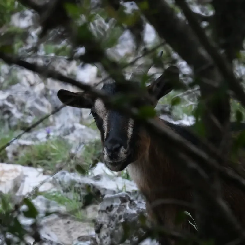
Every morning is a race against the sun. Today, we lost and had to hike quite a long time in the sun. However, it wasn't as bad as expected. We saw a Gypaëte Barbu and Royal Eagle fly over us, two of the majestic birds Ixil had in his to-see list.
We reached a beautiful cabin around 4pm. It is very cute, has mattresses, and a big enough table. People joined one at a time: Guylaine and her boyfriend Tangy, Imed, Charlotte (who lives in Lausanne and offered to take our solar panels with her), and Victor and Thibault. We had a nice evening all together, including chit chat, deer staring with Imed's binoculars, and a yoga lesson lead by Guylaine.
show lessCabane des Arroux → Etang d'Araing
 6 photos
 Instead of staying at a cabin where we were greeted by an angry Patou, we made it to a lake further away where we saw our friends from the day...
Instead of staying at a cabin where we were greeted by an angry Patou, we made it to a lake further away where we saw our friends from the day prior. I (Ixil) drank a pint, Mathilde a lemon syrup and sneaker bars, and we all went down for a swim in the lake.
The key to making it through 1200m+ of uphill climb is to never stop and walk as slowly as possible. You can't understand how much is left, so assume the worst, and make sure no step tires you. In doing so you will walk faster than anyone on the trail constantly stopping to rest.
On our lunch we were questioned by a group of 3 whose job is to teach hikers what not to do when faced with a Patou or a bear. After this impromptu lesson we were gifted stickers and a booklet which we're actually very happy about.
show lessEtang d'Arraing → Cabane du Clot du Lac
 8 photos
 "every day is a race against the sun" Well not today. No, today it was a race against the storm. We were initially in denial. However, once we turned around...
"every day is a race against the sun" Well not today. No, today it was a race against the storm. We were initially in denial. However, once we turned around and saw dark grumbling clouds behind us we hurried our step. Our ponchos were quickly unpacked.
In one morning, we did what we used to do in a day. Going down and up 900m, only to do it all again in the afternoon. The conditions were perfect, the storm having left behind some clouds to give us shade, and being surrounded most of the day with fields of blueberries to handpick in drive-bys.
When we arrive to the cabin, seeing only its silhouette through heavy fog, we find: a table, upper floor, a second room with bunk beds. People have left over ramen and duck paté which we will take. Everything is perfect.
show lessCabane du Clot du Lac → Esbints
 6 photos
 Notice the lack of pictures: it rained the whole day. Even though it made it easier to focus, it also meant no view, soggy shoes and slippery rocks. We struggled...
Notice the lack of pictures: it rained the whole day. Even though it made it easier to focus, it also meant no view, soggy shoes and slippery rocks. We struggled to find a place to eat our lunch: no cabin, no cover.
We met Frank, an Irish guy with great humor who also does the GR10. We discussed over a cider which he kept refilling for us of his own volition. Later, all our friends arrived and we all had a nice meal together.
We are super happy that we chose this gîte. It is a farm owned by a couple who run the place off of trust. The dinner was tasty: an entrée, wine, a rougaille Saucisse for the main, cheese, and homemade icecream. The veggies came from their garden. They also have adorable dogs who would politely ask for pets.
show lessEsbints → Cabane d'Aula
 9 photos
 2 days from now, we will be done. This is a very strange feeling after 30 days trekking, and unfortunately it makes it hard to be in the moment. Most...
2 days from now, we will be done. This is a very strange feeling after 30 days trekking, and unfortunately it makes it hard to be in the moment. Most everyone we have met in Ariège will also stop at Aulus-les-bains, so the "end of trek" mood is everywhere.
In Ariège, we all seem to have the same days. So even if we see less faces, we see said faces every single day and feel as part of a small hiking club of 10 or so people.
The first 3 hours were surreal, we legit thought it had been only 30min. The 1100m ascend is hard to believe with how slow and simple the way up felt. We slowly saw more and more of the blue sky until we decided to shower in a cascade and the fog came back.
show lessCabane d'Aula → St Lizier d'Ustou
 10 photos
 Ariège is for sure the best part of the Pyrénées for trekkers. It has a lot of cabins that are well equipped and not occupied by sheperds. It is less...
Ariège is for sure the best part of the Pyrénées for trekkers. It has a lot of cabins that are well equipped and not occupied by sheperds. It is less accessible by car hence less popular which means you cross few people and feel like the mountains are yours. The paths are some of the most navigable thus far. There are local farms where you can buy fresh products — usually not even guarded, they simply trust you will put the money in the box!
At 3.30pm, we arrived at the camping. It is a cute place with an epicerie that has everything you need. We even got magnums made from Esbintz farm and some homemade lebanese and moroccan desserts. The camping also had a « hiker room » with sofas and a kitchen, perfect for relaxing.
We reorganized the end of our trip. Because of the lack of available trains, we decided to spend one more night in the mountains and stargaze next to a famous waterfall.
show lessSt Lizier d'Ustou → Cascade d'Ars
 6 photos
 Today should've been our last day, but yesterday we decided otherwise. Do we regret it? Because of this, we decided to leave later than usual. Slowly we saw the clouds...
Today should've been our last day, but yesterday we decided otherwise. Do we regret it?
Because of this, we decided to leave later than usual. Slowly we saw the clouds recede and reveal the true beauty of the Ariège. Pine trees and rivers through moyenne-montagne. These are the landscapes I (Ixil) die for.
We took our final bivouac over the Cascade d'Ars: a waterfall spread into 3 floors over 246m of height and the most famous of the Ariège, next to a wide and inviting river, surrounded by smooth rocks and grass. We spent most of our day discussing our plans once we come back. The things we will organize, meals we will eat: KFC, Sushi, Capriccio.
show lessCascade d'Ars → Aulus-les-Bains
 7 photos
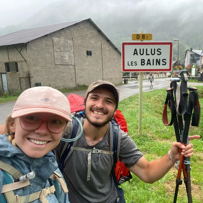
 C'est fini! After waking up in the fog, we walked down for 1h40 to reach Aulus-les-Bains, our final destination. While waiting for the bus at 11am, we allowed ourselves some...
C'est fini! After waking up in the fog, we walked down for 1h40 to reach Aulus-les-Bains, our final destination. While waiting for the bus at 11am, we allowed ourselves some congratulatory snacks including a local patisserie called « mont vallier » filled with blueberries and almonds.
Overall, it's a bitter sweet feeling. We're super happy to get back to comfort, with good food, a bed, clean clothes. But also, it's sad to end this adventure now, especially because we haven't finished the entire traversée (but we will come back).
We will do a few other posts in the next few days, including awards, and maybe comment on the equipment we carried that we needed or didn't, including some advice for those of you preparing your own adventure.
show lessArdèche
Vallon-Pont-d'Arc → Vallon-Pont-d'Arc
 8 photos
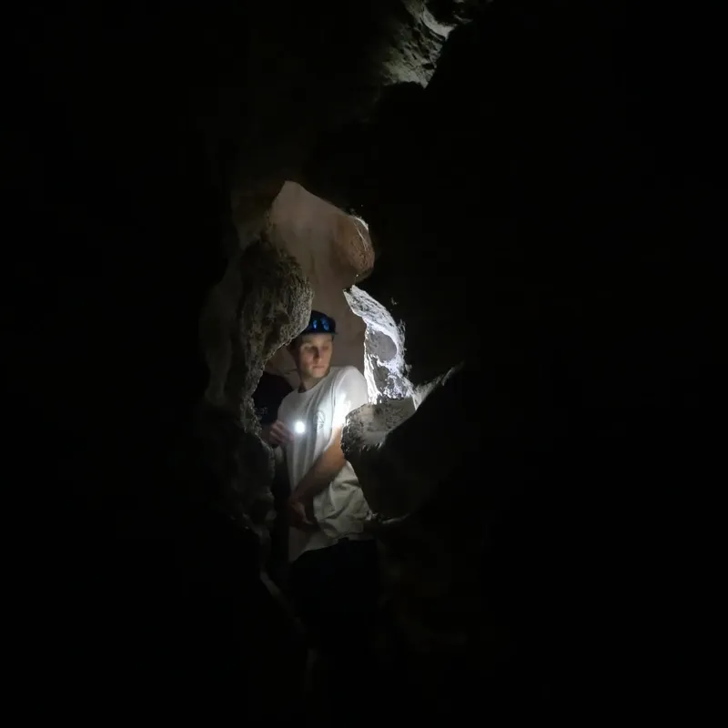
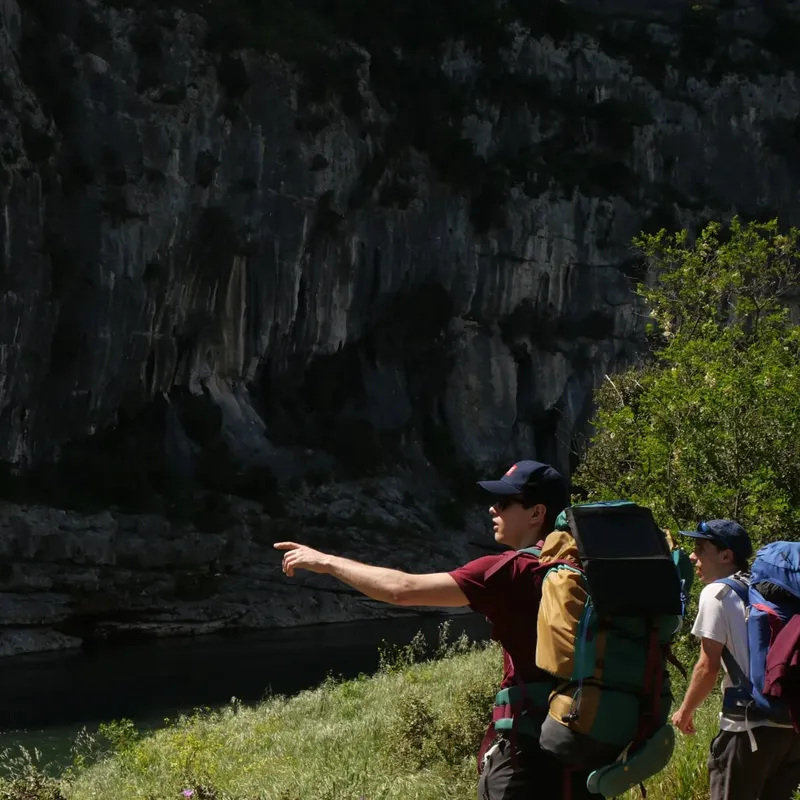
 Probably the most fun, most random and varied trek of my life. From canyoning to cave diving and trail running in flip flops. The Ardèche gorges are a playground of...
Probably the most fun, most random and varied trek of my life. From canyoning to cave diving and trail running in flip flops. The Ardèche gorges are a playground of limestone cliffs, turquoise water, and wild swimming spots. Every day brought something completely different.
show lessVia Rhôna — Bikepacking
Geneva → Sète
14 days of bikepacking from Geneva to the Mediterranean, following the Rhône river south through the French countryside. A different kind of adventure — trading mountain passes for long flat...
14 days of bikepacking from Geneva to the Mediterranean, following the Rhône river south through the French countryside. A different kind of adventure — trading mountain passes for long flat stretches, small villages, and the rhythm of pedaling day after day. From the Swiss border to the shores of Sète, this trip was about endurance, simplicity, and seeing France at cycling speed.
show lessÉcrins
Bourg d'Oisans → Bourg d'Oisans
 9 photos
 Écrins 100% glitchless pantless run — sub 6 days. The Écrins was my first trek with my lead trekking (and life) partner Mathilde. Despite being early I still look back...
Écrins 100% glitchless pantless run — sub 6 days. The Écrins was my first trek with my lead trekking (and life) partner Mathilde. Despite being early I still look back very fondly on it. The views were great, the camping spots wild and improvised, and going through Aile Froide, discovering such an iconic place despite having never heard of it prior, felt quite magical. All I want to do is go back again but with a harness and climbing friends.
show lessVercors — Winter
Villard-de-Lans → Villard-de-Lans
 5 photos
 Pokemon trainer gets lost on a mountain for like 5 days. This was the trek that started it all — frustrated with covid lockdowns, I decided to try snow trekking...
Pokemon trainer gets lost on a mountain for like 5 days. This was the trek that started it all — frustrated with covid lockdowns, I decided to try snow trekking in the Vercors plateau. Despite the cold and the solitude, it became one of the most formative experiences of my life and kick-started a passion for multi-day hikes.
show less